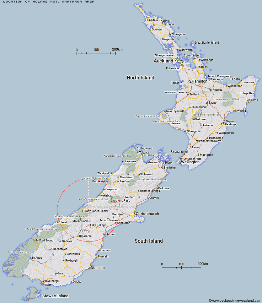
Topo Map showing location of Nolans Hut
This information is sourced from DoC, LINZ and Openstreetmap. Some of the hut photos are mine and the rest are from DoC. I will be adding an upload feature soon so people can photos of .Nolans Hut.
Basic info: basic four-bunk hut in the Glaciers area.
Latitude: -43.3484491388
Longitude: 170.482050004
Location: Whataroa area
Area: West Coast
Type of Hut: Basic/bivvies
Tracks: Whataroa, Butler and Perth valleys tracks
Map: BW16 Topo Map | Road Map
Does this hut still exist? Have any more information? Contact
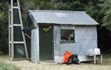
Image: DoC
Scroll down to see a topographical map and road map showing the location of Nolans Hut
[ A ] [ B ] [ C ] [ D ] [ E ] [ F ] [ G ] [ H ] [ I ] [ J ] [ K ] [ L ] [ M ] [ N ] [ O ] [ P ] [ Q ] [ R ] [ S ] [ T ] [ U ] [ V ] [ W ] [ Y ] [ Z ]
Closest 20 Huts to Nolans Hut
These are as the crow fliesNolans Hut 0km Stan's Hut 6.46km Scone Hut 7.67km Butler Junction Hut 8.57km Top Butler Hut 8.68km Whymper Hut 13.71km Godley Hut 14.85km Saint Winifreds Hut 17.95km Forbes Bivouac 18.64km Eade Memorial Hut 19.01km Spencer Rock Bivouac 19.76km Murchison Hut 20.19km Mistake Flats Hut 20.39km Murphys Bivvy 20.61km Kelman Hut 21.36km Red Stag Hut 21.38km Tasman Saddle Hut 21.59km Curtis Memorial Hut 21.91km Carneys Bivvy's 21.96km McCoy Hut 23.96km Watchdog Hut 25.64km Hunters Hut 25.71km Almer Hut 26.17km Hende's Hut 26.33km Centennial Hut 26.77km Growler Hut 27.5km Macaulay Hut 27.6km Castle Rocks Hut 27.99km Rankin Hut 28.23km Scamper Torrent Hut 29.95km Pioneer Hut 31.57km Erewhon Station Hut 31.59km Kiwi Flat Hut 31.93km Onslow Hut (Steffan Memorial Hut) 32.28km Smyth Hut 33.5km Lawrence Hut 33.55km Angus Hut 34.04km Liebig Hut 34.1km Black Mountain Hut 34.7km Haast Hut 34.78km