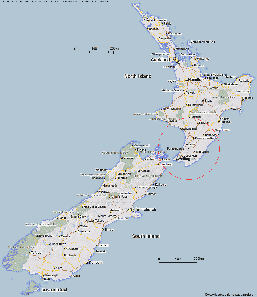
Topo Map showing location of Nichols Hut
This information is sourced from DoC, LINZ and Openstreetmap. Some of the hut photos are mine and the rest are from DoC. I will be adding an upload feature soon so people can photos of .Nichols Hut.
Basic info: standard six-bunk hut in the Wairarapa region.
Latitude: -40.8102354175
Longitude: 175.375921367
Location: Tararua Forest Park
Area: Wairarapa
Type of Hut: Standard
Map: BN33 Topo Map | Road Map
Does this hut still exist? Have any more information? Contact
Basic info: standard six-bunk hut in the Wairarapa region.
Latitude: -40.8102354175
Longitude: 175.375921367
Location: Tararua Forest Park
Area: Wairarapa
Type of Hut: Standard
Map: BN33 Topo Map | Road Map
Does this hut still exist? Have any more information? Contact
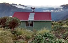
Image: DoC
Scroll down to see a topographical map and road map showing the location of Nichols Hut
[ A ] [ B ] [ C ] [ D ] [ E ] [ F ] [ G ] [ H ] [ I ] [ J ] [ K ] [ L ] [ M ] [ N ] [ O ] [ P ] [ Q ] [ R ] [ S ] [ T ] [ U ] [ V ] [ W ] [ Y ] [ Z ]
Closest 20 Huts to Nichols Hut
These are as the crow fliesCarkeek Hut 2.81km McGregor Bivouac 3.86km Dorset Ridge Hut 3.92km Anderson Memorial Hut 4.36km Dracophyllum Hut 4.65km Tarn Ridge Hut 5.5km Waitewaewae Hut 6.3km Mid King Bivouac 6.39km Mid Waiohine Hut 7.11km Jumbo Hut 7.27km Te Matawai Hut 8.31km Arete Forks Hut 8.37km Arete Hut 8.57km Mitre Flats Hut 8.94km Aokaparangi Hut 9.17km Atiwhakatu Hut 9.2km Powell Hut 9.23km Waiopehu Hut 9.46km South Ohau Hut 10.32km Cow Creek Hut 10.38km Mountain House Shelter 10.49km Maungahuka Hut 11.88km Blue Range Hut 12.16km Penn Creek Hut 12.64km North Ohau Hut 12.8km Dundas Hut 12.89km Neill Forks Hut 13.72km Totara Flats Hut 13.81km Cattle Ridge Hut 13.97km Mangahao Flats Hut 14.1km Waikawa Shelter 14.72km Field Hut 14.8km Sayer Hut 15.23km Roaring Stag Hut 15.33km Kime Hut 17.15km Herepai Hut 18.06km Cone Hut 19.86km Alpha Hut 21.06km Waiotauru Hut 21.5km Elder Hut 21.64km