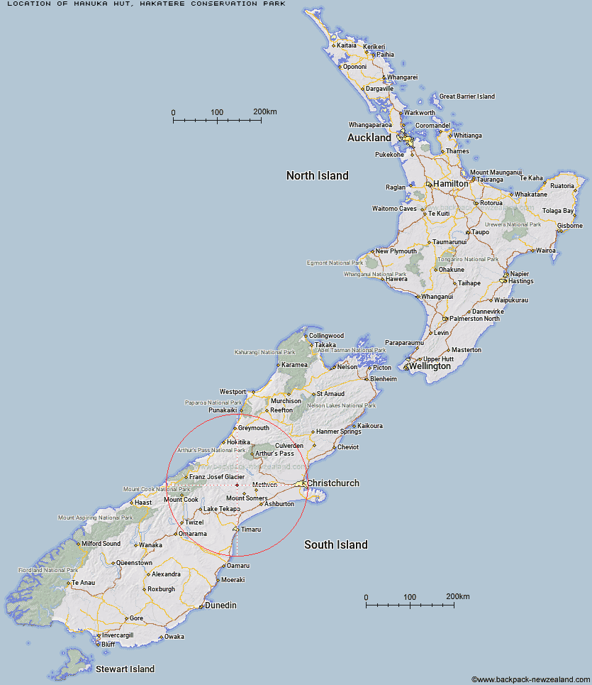
Topo Map showing location of Manuka Hut
This information is sourced from DoC, LINZ and Openstreetmap. Some of the hut photos are mine and the rest are from DoC. I will be adding an upload feature soon so people can photos of .Manuka Hut.
Basic info: Manuka Hut is a basic hut in the Mid and South Canterbury backcountry area.
Latitude: -43.5358235913
Longitude: 171.254404462
Location: Hakatere Conservation Park
Area: Canterbury
Type of Hut: Basic/bivvies
Map: BX19 Topo Map | Road Map
Does this hut still exist? Have any more information? Contact
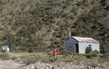
Image: DoC
Scroll down to see a topographical map and road map showing the location of Manuka Hut
[ A ] [ B ] [ C ] [ D ] [ E ] [ F ] [ G ] [ H ] [ I ] [ J ] [ K ] [ L ] [ M ] [ N ] [ O ] [ P ] [ Q ] [ R ] [ S ] [ T ] [ U ] [ V ] [ W ] [ Y ] [ Z ]
Closest 20 Huts to Manuka Hut
These are as the crow fliesDouble Hut 4.5km Three Creeks Hut 8.67km Woolshed Creek Hut 9.27km Lagoon Hut 13.03km Pinnacles Hut 13.21km Alford Hut 14.76km Boundary Creek Hut 14.77km Comyns Hut 14.98km Cookshop Hut 15.21km Cookies Hut 16.16km Cutty Grass Hut 17.73km Charlies Hut 18.28km Tribulation Hut 18.78km A Frame Hut 19.41km Highland Home 19.86km Top Hut 22.25km Potts Hut 23.41km Downs Hut 24.9km Cameron Hut 26.76km Thompsons Hut 28.58km Jellicoe Hut 30.49km Banfield Hut 30.88km Hermitage Hut 31.68km Taffy Hut 31.9km Lawrence Hut 32.42km Top Mount Peel Huts 32.44km Lawrence Bivouac 34.07km Erewhon Station Hut 34.18km Washbourne Hut 34.54km Black Mountain Hut 34.92km Evans Hut 35.62km Dog Kennel Bivouac 36.19km Bottom Mount Peel Hut 36.43km Reischek Hut 36.88km Ribbonwood Hut 36.99km Lauper Bivouac 37.81km Lyell Hut 38.31km Crooked Spur Hut 38.7km Mathias Hut 40.03km Watchdog Hut 40.19km