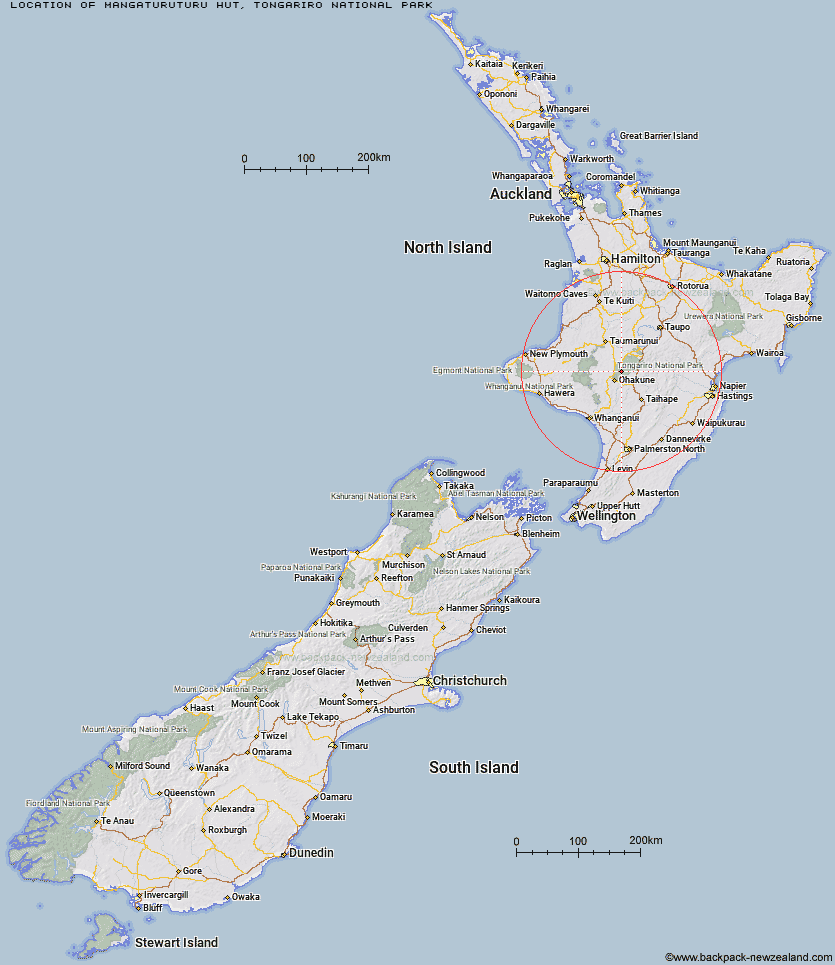
Topo Map showing location of Mangaturuturu Hut
This information is sourced from DoC, LINZ and Openstreetmap. Some of the hut photos are mine and the rest are from DoC. I will be adding an upload feature soon so people can photos of .Mangaturuturu Hut.
Basic info: serviced 10-bunk hut in the Ruapehu area.
Latitude: -39.2969410331
Longitude: 175.501805675
Location: Tongariro National Park
Area: Central North Island
Type of Hut: Serviced
Tracks: Round the Mountain Track
Map: BJ34 Topo Map | Road Map
Does this hut still exist? Have any more information? Contact
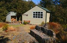
Image: DoC
Scroll down to see a topographical map and road map showing the location of Mangaturuturu Hut
[ A ] [ B ] [ C ] [ D ] [ E ] [ F ] [ G ] [ H ] [ I ] [ J ] [ K ] [ L ] [ M ] [ N ] [ O ] [ P ] [ Q ] [ R ] [ S ] [ T ] [ U ] [ V ] [ W ] [ Y ] [ Z ]
Closest 20 Huts to Mangaturuturu Hut
These are as the crow fliesLupton Hut 4.35km Blyth Hut 4.36km Mangaehuehu Hut 6.6km Whakapapaiti Hut 6.73km Whangaehu Hut 7.64km Rangipo Hut 10.51km Old Waihohonu Hut 17.64km Waihohonu Hut 18.15km Mangatepopo Hut 18.8km Oturere Hut 22.29km Ketetahi Shelter 24.72km Ten Man Hut 31.51km Zekes Hut 34.33km Westlawn Hut 35.06km Bob's Hut 42.08km Waipakihi Hut 43.78km Tieke Kainga 43.99km Puketotara Hut 45.56km Ohuraiti Hut 48.14km Te Apunga Hut 50.37km John Coull Hut 51.14km Ngapurua Hut 51.69km Pouri Hut 56.15km Golden Hills Hut 57.02km WTFRW Hut 57.18km Downes hut 57.35km Cascade Hut 59km Hauhungaroa Hut 60.9km Otutu Island Hut 61.36km Cedars Hut (Blowfly) 61.6km Puteore Hut 61.77km Omaru Hut 62.33km Otutu Hut 62.98km Rock Camp Bivouac 63.16km Tussock Hut 63.17km Tahupo Hut 64.34km Harkness Hut 64.49km Ngaawapurua Hut 64.71km Manson Hut 65.24km Old Manson Hut 65.49km