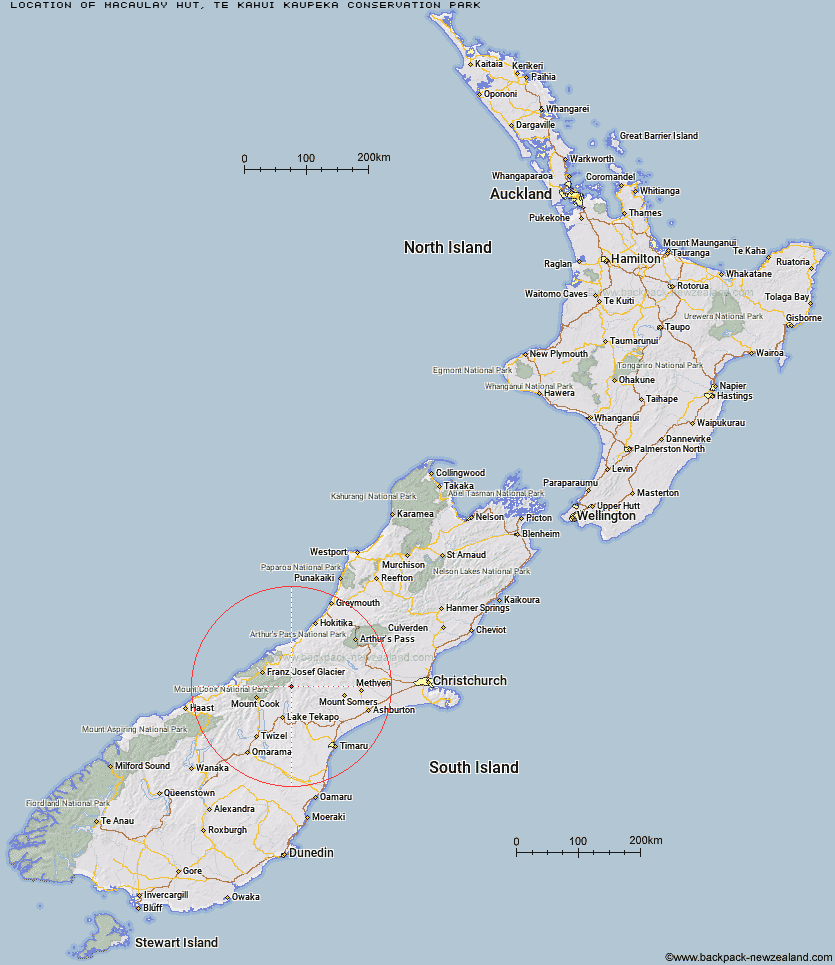
Topo Map showing location of Macaulay Hut
This information is sourced from DoC, LINZ and Openstreetmap. Some of the hut photos are mine and the rest are from DoC. I will be adding an upload feature soon so people can photos of .Macaulay Hut.
Basic info: serviced 14-bunk hut in the Mackenzie Country and Waitaki area.
Latitude: -43.5804724345
Longitude: 170.603430903
Location: Te Kahui Kaupeka Conservation Park
Area: Canterbury
Type of Hut: Serviced
Tracks: Macaulay Hut Track
Map: BX17 Topo Map | Road Map
Does this hut still exist? Have any more information? Contact
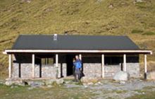
Image: DoC
Scroll down to see a topographical map and road map showing the location of Macaulay Hut
[ A ] [ B ] [ C ] [ D ] [ E ] [ F ] [ G ] [ H ] [ I ] [ J ] [ K ] [ L ] [ M ] [ N ] [ O ] [ P ] [ Q ] [ R ] [ S ] [ T ] [ U ] [ V ] [ W ] [ Y ] [ Z ]
Closest 20 Huts to Macaulay Hut
These are as the crow fliesRed Stag Hut 9.29km Stony Stream Hut 9.7km Carneys Bivvy's 10.51km Rankin Hut 10.57km Eade Memorial Hut 11.92km Angus Hut 13.24km Forbes Bivouac 13.35km Growler Hut 13.37km Godley Hut 13.42km Murphys Bivvy 13.88km Crooked Spur Hut 15.75km Ribbonwood Hut 16km Mistake Flats Hut 16.4km Dog Kennel Bivouac 16.66km Curtis Memorial Hut 16.74km Stone Hut 17.91km Black Mountain Hut 18.11km Murchison Hut 18.2km Saint Winifreds Hut 19.27km Royal Hut 19.29km Birdcage Hut 20.58km Kelman Hut 20.69km Memorial Hut 20.69km Rex Simpson Hut 21.02km Top Butler Hut 22.13km Tasman Saddle Hut 22.34km Scone Hut 22.93km Middle Gorge Hut 23.45km Felt Hut 23.97km Camp Stream Hut 24.01km Onslow Hut (Steffan Memorial Hut) 24.1km Tin Hut 24.14km Liebig Hut 24.18km Whymper Hut 24.22km Watchdog Hut 24.28km Butler Junction Hut 24.53km Erewhon Station Hut 24.7km Ryders Hut 25.67km McCoy Hut 26.42km Nolans Hut 27.6km