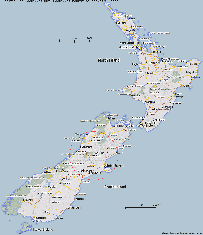
Topo Map showing location of Lochinvar Hut
This information is sourced from DoC, LINZ and Openstreetmap. Some of the hut photos are mine and the rest are from DoC. I will be adding an upload feature soon so people can photos of .Lochinvar Hut.
Basic info: standard six-bunk hut in the North Canterbury and Arthur's Pass area.
Latitude: -42.9344225983
Longitude: 172.007369467
Location: Lochinvar Forest Conservation Area
Area: Canterbury
Type of Hut: Standard
Map: BV22 Topo Map | Road Map
Does this hut still exist? Have any more information? Contact
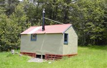
Image: DoC
Scroll down to see a topographical map and road map showing the location of Lochinvar Hut
[ A ] [ B ] [ C ] [ D ] [ E ] [ F ] [ G ] [ H ] [ I ] [ J ] [ K ] [ L ] [ M ] [ N ] [ O ] [ P ] [ Q ] [ R ] [ S ] [ T ] [ U ] [ V ] [ W ] [ Y ] [ Z ]
Closest 20 Huts to Lochinvar Hut
These are as the crow fliesBull Creek Hut 5.59km Ant Stream Hut 7.84km Anna Hut 8.1km Turnbull Bivouac 8.4km Ant Stream Bivouac 10.38km Candlesticks Bivouac 11.8km Ranger Bivouac 12.58km Anderson's Hut 12.69km North Esk Hut 15.74km Cattle Creek Hut 15.85km Trust/Poulter Hut 16.07km Tarn Hut 16.37km Youngman Stream Hut 17.5km Esk Bivouac 18.04km Bush Camp Hut 18.64km Poulter Hut 18.66km Andrews Shelter 18.66km Upper South Branch Hurunui Hut 19.03km East Hawdon Bivouac 19.21km Lilburne Hut 19.3km Puketeraki Bivouac 19.95km Riversdale Hut 19.96km Deep Creek Hut 20.11km Worsley Bivouac 20.47km Hamilton Hut 20.73km Stony Stream Hut 21.22km South Branch Research Hut 21.8km Hawdon Shelter 21.97km Minchin Bivouac 22.35km Hawdon Hut 22.51km Poulter Bivouac 23.39km Seldom Inn Hut 23.72km Sudden Valley Bivouac 24.7km Harper Pass Bivouac 24.98km Camerons Hut 25.27km Lake Mason Hut 25.28km Lower Salmon Creek Bivouac 25.37km Otehake Hut 25.63km Townsend Hut 25.85km Locke Stream Hut 26.01km