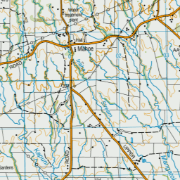
Topo Map showing location of Lake Dive Hut
This information is sourced from DoC, LINZ and Openstreetmap. Some of the hut photos are mine and the rest are from DoC. I will be adding an upload feature soon so people can photos of .Lake Dive Hut.
Basic info: Nestled on the shore of Lake Dive, Lake Dive Hut is a popular overnight destination. Calm days offer great reflections of Fanthams Peak in the lake.
Latitude: -39.336110716
Longitude: 174.060734507
Location: Dawson Falls area, Egmont National Park
Area: Taranaki
Type of Hut: Serviced
Tracks: Lake Dive Hut tracks|Around the Mountain Circuit
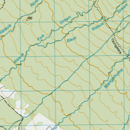
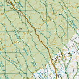
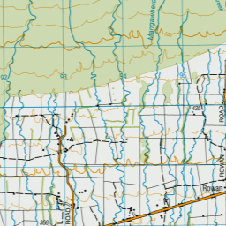
Map: BJ29 Topo Map | Road Map
Does this hut still exist? Have any more information? Contact
Basic info: Nestled on the shore of Lake Dive, Lake Dive Hut is a popular overnight destination. Calm days offer great reflections of Fanthams Peak in the lake.
Latitude: -39.336110716
Longitude: 174.060734507
Location: Dawson Falls area, Egmont National Park
Area: Taranaki
Type of Hut: Serviced
Tracks: Lake Dive Hut tracks|Around the Mountain Circuit
Map: BJ29 Topo Map | Road Map
Does this hut still exist? Have any more information? Contact
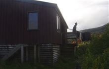
Image: DoC
Scroll down to see a topographical map and road map showing the location of Lake Dive Hut
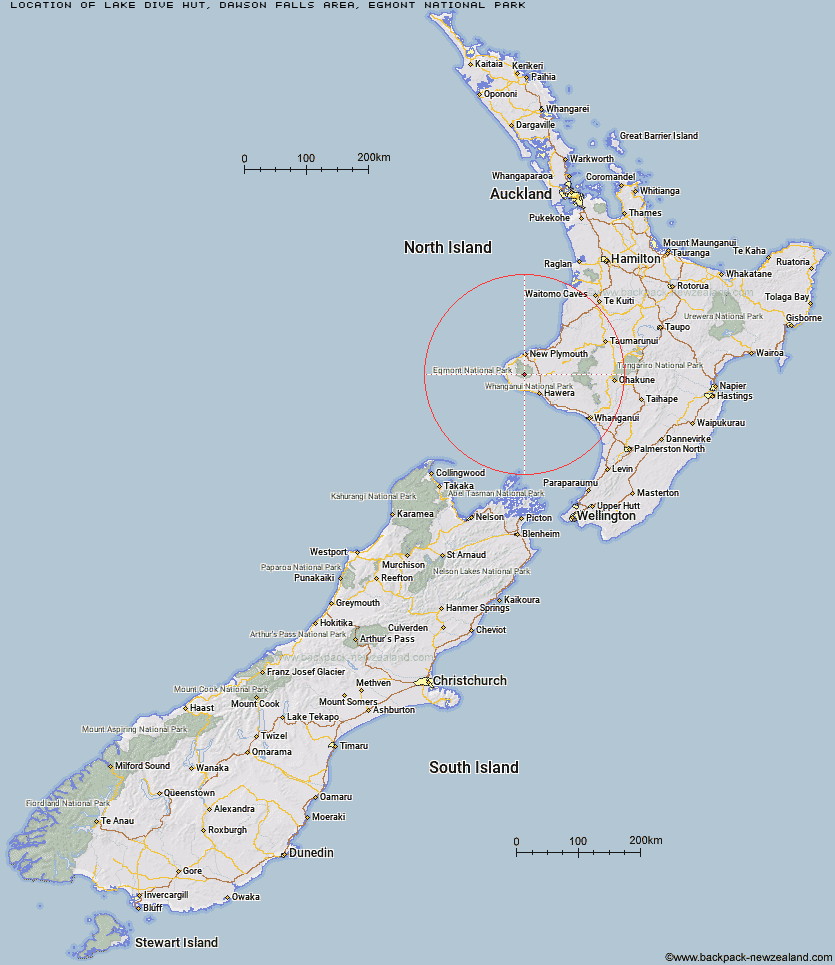

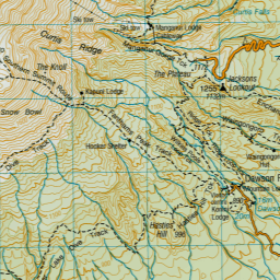
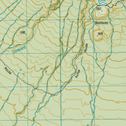
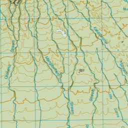
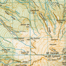
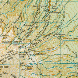
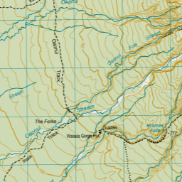
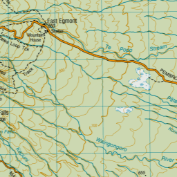

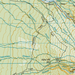
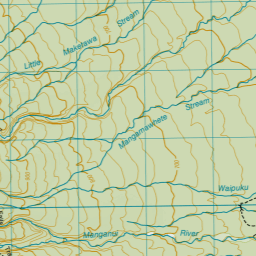

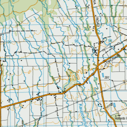
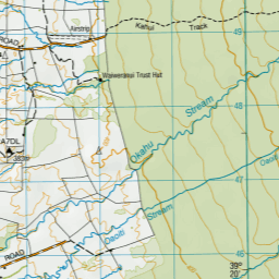
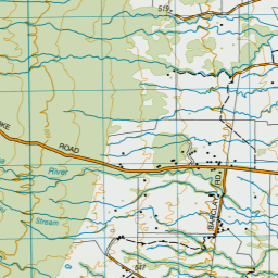
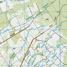
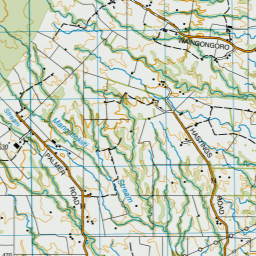
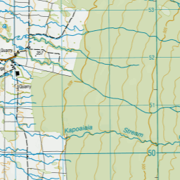
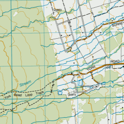


Leaflet | Sourced from LINZ. CC BY 4.0


Leaflet | Map data © OpenStreetMap contributors
[ A ] [ B ] [ C ] [ D ] [ E ] [ F ] [ G ] [ H ] [ I ] [ J ] [ K ] [ L ] [ M ] [ N ] [ O ] [ P ] [ Q ] [ R ] [ S ] [ T ] [ U ] [ V ] [ W ] [ Y ] [ Z ]
Closest 20 Huts to Lake Dive Hut
These are as the crow fliesSyme Hut 3.01km Hooker Shelter 3.1km Waingongoro Hut 4.69km Waiaua Gorge Hut 5.05km Kahui Hut 6.13km Maketawa Hut 6.9km Holly Hut 8km Waiweranui Trust Hut 9.84km Kaiauai Shelter 10.96km Pouakai Hut 11.4km Trains Hut 59.68km Omaru Hut 61.94km Tahupo Hut 62.28km Puteore Hut 62.79km Pouri Hut 67.98km Rerekapa Hut 72.39km Ngapurua Hut 72.99km John Coull Hut 74.28km Puketotara Hut 78.77km Tieke Kainga 80.19km Ohuraiti Hut 89.77km Downes hut 101.56km Leitchs Hut 118.18km Mangaturuturu Hut 124.05km Ten Man Hut 124.72km Lupton Hut 125.69km Whakapapaiti Hut 125.86km Blyth Hut 125.94km Mangaehuehu Hut 128.08km Whangaehu Hut 131.59km Mangatepopo Hut 133.98km Rangipo Hut 134.52km Old Waihohonu Hut 139.47km Ketetahi Shelter 139.48km Waihohonu Hut 140.08km Oturere Hut 141.61km Hauhungaroa Hut 141.75km Zekes Hut 146.58km Hamilton Tomo Group Hut 149.83km Waihaha Hut 150.94km