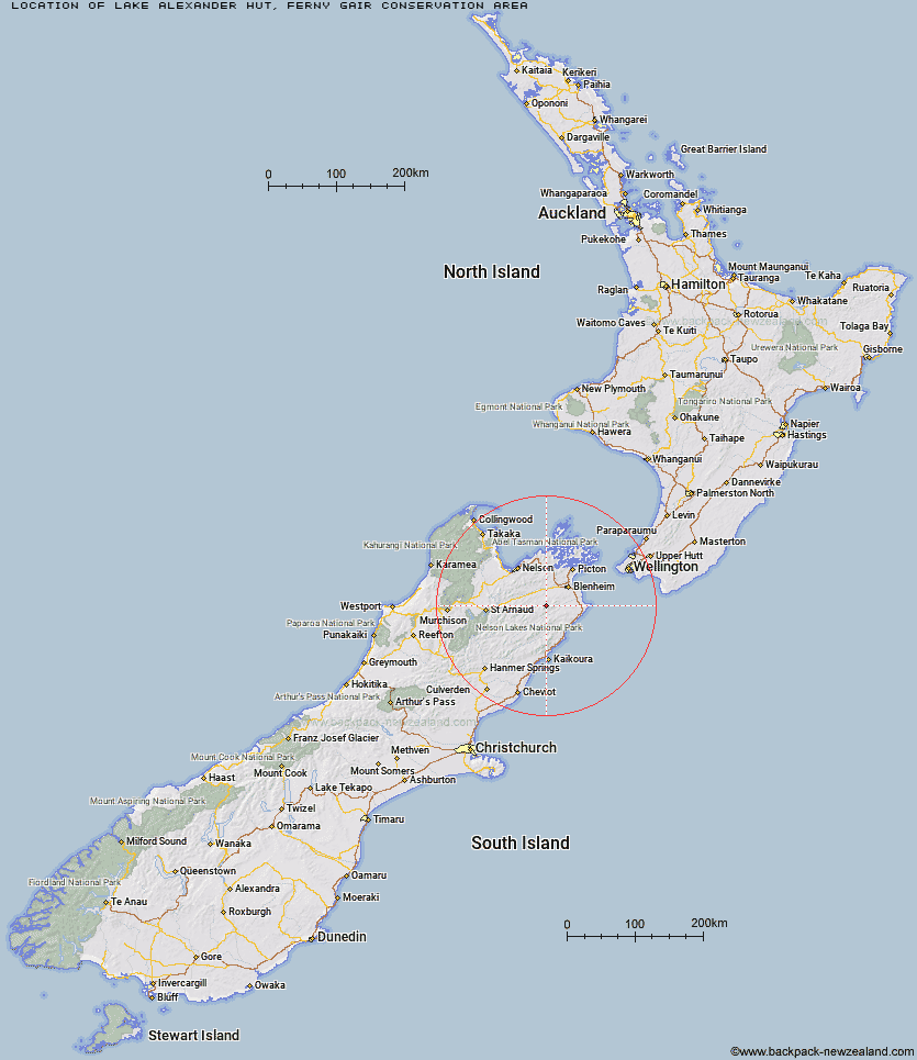
Topo Map showing location of Lake Alexander Hut
This information is sourced from DoC, LINZ and Openstreetmap. Some of the hut photos are mine and the rest are from DoC. I will be adding an upload feature soon so people can photos of .Lake Alexander Hut.
Basic info: Lake Alexander Hut is a standard 6-bunk hut in the South Marlborough area.
Latitude: -41.74939922
Longitude: 173.661901456
Location: Ferny Gair Conservation Area
Area: Marlborough
Type of Hut: Standard
Map: BR27 Topo Map | Road Map
Does this hut still exist? Have any more information? Contact
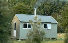
Image: DoC
Scroll down to see a topographical map and road map showing the location of Lake Alexander Hut
[ A ] [ B ] [ C ] [ D ] [ E ] [ F ] [ G ] [ H ] [ I ] [ J ] [ K ] [ L ] [ M ] [ N ] [ O ] [ P ] [ Q ] [ R ] [ S ] [ T ] [ U ] [ V ] [ W ] [ Y ] [ Z ]
Closest 20 Huts to Lake Alexander Hut
These are as the crow fliesPenk Hut 4.55km Dillon Hut 7.03km McNaughts Hut 8.33km Omaka Bivouac 8.61km Ramshead Hut 12.62km Beehive Hut 13.1km Black Birch Bivouac 13.63km Cam Hut 17.94km Flynns 19.23km Tinpot Hut 21.39km Top Whare 22.02km Swale Hut 24.01km Beechs Hut 24.43km Gosling Hut 26.59km Old Middlehurst Hut 26.84km Mead Hut 27.49km Turkeys Nest Bivouac 28.21km Dee Hut 28.72km Zoo Hut 29.27km Hidden Hut 30.39km Blue Mountain Hut 30.71km Whernside Hut 30.79km Chimney 30.97km Cabbage Tree Hut 31.11km Gibson Hut 31.31km Isolation Hut 31.54km Boulder Forks Hut 34.1km Snowgrass Hut 34.22km Lake Chalice Hut 34.84km Fosters Hut 35.45km Hornby Bivvy 36.05km Fishtail Hut 36.64km Ravine Hut 36.82km Devils Creek Hut 37.73km Mt Sunday Bivouac 37.86km Burnt Yards Hut 38.35km Richmond Saddle Hut 38.4km Mt Fell Hut 38.4km Jam Hut 38.74km Caves Hut 39.64km