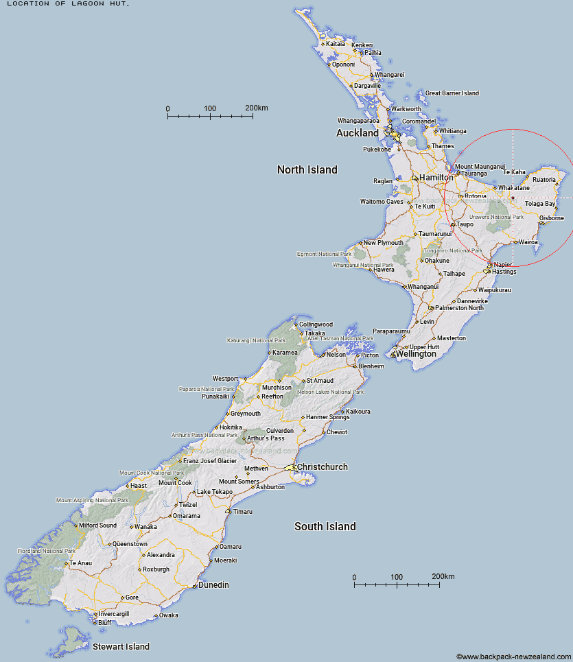
Topo Map showing location of Lagoon Hut
This information is sourced from DoC, LINZ and Openstreetmap. Some of the hut photos are mine and the rest are from DoC. I will be adding an upload feature soon so people can photos of .Lagoon Hut.
Latitude: -38.1627854734
Longitude: 177.363207179
Location:
Type of Hut:
Map: Topo Map | Road Map
Does this hut still exist? Have any more information? Contact
Latitude: -38.1627854734
Longitude: 177.363207179
Location:
Type of Hut:
Map: Topo Map | Road Map
Does this hut still exist? Have any more information? Contact
Scroll down to see a topographical map and road map showing the location of Lagoon Hut
[ A ] [ B ] [ C ] [ D ] [ E ] [ F ] [ G ] [ H ] [ I ] [ J ] [ K ] [ L ] [ M ] [ N ] [ O ] [ P ] [ Q ] [ R ] [ S ] [ T ] [ U ] [ V ] [ W ] [ Y ] [ Z ]
Closest 20 Huts to Lagoon Hut
These are as the crow fliesLagoon Hut 0km Hastings Hut 2.91km Te Waiti Hut 3.52km Brills Bivouac 4.22km Savlon Hut 4.72km Tokenui Hut 7.94km Pakihi Hut 9.16km Wahaatua Hut 9.26km Pakihi Heads Hut 13.42km Manganuku Hut 13.67km Kotepato Hut 19.28km Nikau Flat Hut 22.35km Koaunui Hut 25.62km Koranga Forks Hut 26.9km Wharekahika Hut 30.27km Tawa Hut 31.39km Onepu Hut 31.52km Otapukawa Hut 31.65km Mangakirikiri Hut 32.19km Ohora Hut 34.53km Tataweka Hut 35.14km Otane Hut 35.42km Kahunui Hut 36.04km Te Pourewa Hut 36.28km Makakoere Hut 36.47km Mangaotane Hut (McMillans) 36.66km Apiti Hut 37.19km Twain (Waipotiki) Hut 37.35km Ohane Hut 38.99km Saddle (Mangaawai) Hut 39.02km Te Pua Hut 39.3km Te Panaa Hut 40.22km Waikare Junction Hut 40.42km Te Rangaakapua Hut 42.2km Casino Hut 43.11km Waihua Hut 43.4km Mangatoatoa Hut 44.04km Otanetea Hut 45.37km Mangamako Hut 45.79km Taurawharona Hut 45.85km