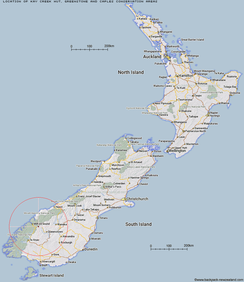
Topo Map showing location of Kay Creek Hut
This information is sourced from DoC, LINZ and Openstreetmap. Some of the hut photos are mine and the rest are from DoC. I will be adding an upload feature soon so people can photos of .Kay Creek Hut.
Basic info: basic four-bunk hut in the Queenstown/Wakatipu area.
Latitude: -44.7991364576
Longitude: 168.246396641
Location: Greenstone and Caples Conservation Areas
Area: Otago
Type of Hut: Basic/bivvies
Map: CB09 Topo Map | Road Map
Does this hut still exist? Have any more information? Contact
Basic info: basic four-bunk hut in the Queenstown/Wakatipu area.
Latitude: -44.7991364576
Longitude: 168.246396641
Location: Greenstone and Caples Conservation Areas
Area: Otago
Type of Hut: Basic/bivvies
Map: CB09 Topo Map | Road Map
Does this hut still exist? Have any more information? Contact
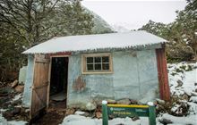
Image: DoC
Scroll down to see a topographical map and road map showing the location of Kay Creek Hut
[ A ] [ B ] [ C ] [ D ] [ E ] [ F ] [ G ] [ H ] [ I ] [ J ] [ K ] [ L ] [ M ] [ N ] [ O ] [ P ] [ Q ] [ R ] [ S ] [ T ] [ U ] [ V ] [ W ] [ Y ] [ Z ]
Closest 20 Huts to Kay Creek Hut
These are as the crow fliesUpper Caples Hut 5.34km Lake Mackenzie Lodge 6.68km Lake Mackenzie Hut 6.73km Routeburn Flats Hut 8.53km Routeburn Falls Lodge 8.93km Routeburn Falls Hut 8.95km Lake Howden Hut 8.95km Routeburn Shelter 9.27km Mid Caples Hut 10.53km The Divide Shelter 10.56km McKellar Lodge 11.25km McKellar Hut 11.36km Home Hill Hut 13.27km Steele Creek Hut 14.45km McIntyre's Hut 16.19km Jean Hut 16.88km Rats Nest Hut 16.92km McIntosh Hut 16.96km Bonnie Jean Hut 17.33km Phil's Bivvy 17.57km Heather Jock Hut 17.61km Slip Flat Hut 17.62km Gill's Bivvy 18.16km Steele Creek Lodge 18.27km Homer Hut 19.56km Wallers Hut 19.65km Greenstone Hut 20.07km Kelly's Hut 20.39km Sunshine Hut 21.44km Hidden Falls Hut 22.13km Esquilant Bivvy Hut 24.05km Twenty Five Mile Hut 24.98km Earnslaw Hut 25.33km Turners Bivouac 26.7km Stoney Creek Hut 27.46km Taipo Hut 28.01km Glade House 28.49km Clinton Hut 29.17km Lake Alabaster Hut 29.3km Daleys Flat Hut 29.68km