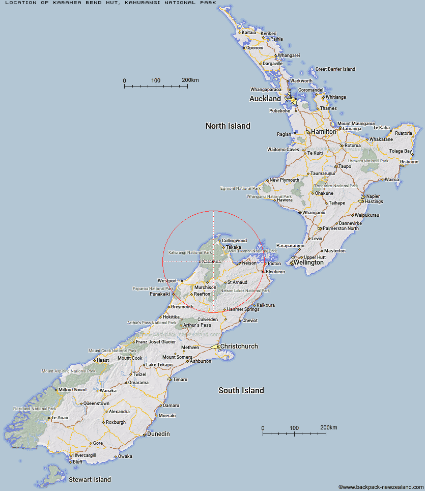
Topo Map showing location of Karamea Bend Hut
This information is sourced from DoC, LINZ and Openstreetmap. Some of the hut photos are mine and the rest are from DoC. I will be adding an upload feature soon so people can photos of .Karamea Bend Hut.
Basic info: standard 22-bunk hut in the Motueka area.
Latitude: -41.2330838203
Longitude: 172.511003275
Location: Kahurangi National Park
Area: Nelson/Tasman
Type of Hut: Standard
Tracks: Leslie-Karamea Track
Map: BQ23 Topo Map | Road Map
Does this hut still exist? Have any more information? Contact
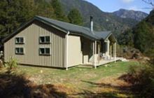
Image: DoC
Scroll down to see a topographical map and road map showing the location of Karamea Bend Hut
[ A ] [ B ] [ C ] [ D ] [ E ] [ F ] [ G ] [ H ] [ I ] [ J ] [ K ] [ L ] [ M ] [ N ] [ O ] [ P ] [ Q ] [ R ] [ S ] [ T ] [ U ] [ V ] [ W ] [ Y ] [ Z ]
Closest 20 Huts to Karamea Bend Hut
These are as the crow fliesRoaring Lion Hut 7.56km Crow Hut 7.59km Flanagans Hut 7.96km Splugeons Rock Shelter 8.73km Venus Hut 11.07km Balloon Hut 11.73km Dry Rock Shelter 13.92km Trilobite Hut 14.08km Myttons Hut 14.24km Ellis Hut 14.62km Thor Hut 14.66km Growler Rock Shelter 15.56km Chaffey Hut 16.17km Upper Gridiron Hut and Rock Shelters 17.01km Mt Arthur Hut 17.57km Sylvester Hut 18km Tent Camp 18.69km Asbestos Cottage 19.01km John Reid Hut 19.08km Flora Hut 19.16km Kiwi Saddle Hut 19.39km Greys Hut 19.69km Cobb Hut 19.73km Fenella Hut 20.44km Kākāpō Hut 20.55km Trevor Carter Hut 20.93km Stone Hut 21.69km Helicopter Flat Hut 23.89km Taipo Hut 24.65km Waingaro Forks Hut 24.93km Adams Flat Hut 25.27km Wangapeka Bivouac 25.46km Stag Flat Shelter 25.57km Kings Creek Hut 25.96km Cecil Kings Hut 26.14km Soper Shelter 26.22km Belltown Manunui Hut 26.32km Sunshine Flat Shelter 26.81km Lonely Lake Hut 28.13km Riordans Hut 28.49km