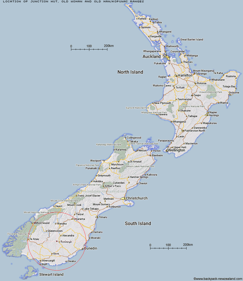
Topo Map showing location of Junction Hut
This information is sourced from DoC, LINZ and Openstreetmap. Some of the hut photos are mine and the rest are from DoC. I will be adding an upload feature soon so people can photos of .Junction Hut.
Basic info: standard six-bunk hut in the Central Otago area.
Latitude: -45.5106629961
Longitude: 169.184034162
Location: Old Woman and Old Man/Kopuwai Ranges
Area: Otago
Type of Hut: Standard
Map: CD12 Topo Map | Road Map
Does this hut still exist? Have any more information? Contact
Basic info: standard six-bunk hut in the Central Otago area.
Latitude: -45.5106629961
Longitude: 169.184034162
Location: Old Woman and Old Man/Kopuwai Ranges
Area: Otago
Type of Hut: Standard
Map: CD12 Topo Map | Road Map
Does this hut still exist? Have any more information? Contact
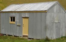
Image: DoC
Scroll down to see a topographical map and road map showing the location of Junction Hut
[ A ] [ B ] [ C ] [ D ] [ E ] [ F ] [ G ] [ H ] [ I ] [ J ] [ K ] [ L ] [ M ] [ N ] [ O ] [ P ] [ Q ] [ R ] [ S ] [ T ] [ U ] [ V ] [ W ] [ Y ] [ Z ]
Closest 20 Huts to Junction Hut
These are as the crow fliesJunction Hut 0km Christies Hut 6.78km Potters Huts 9.81km Andrew Rees Hut 10.08km Bush Huts 10.62km McCrimmons Hut 15.25km Diggers Hut 15.29km Black Hut 16.79km Titan Huts 16.83km Nicholsons Hut 17.54km Stronach Hut 17.9km Blue Lake Huts 19.45km Boundary Hut 20.33km Junction Hut 23.01km Flaxy Hut 23.99km Whites Hut 27.68km Leithen Hut 29.31km Dome Hut 30.31km Beaumont Hut 31.59km Hyde Home Hut 31.63km Baileys Hut 31.72km Jim Baird Hut 33.97km Sullivan Hut 34.03km Slate Hut 34.07km Garston Ski Hut 34.57km Old Woman Hut 34.79km Mud Hut 34.84km Cairnmuir Musterer's Hut 44.73km Canadian Hut 46.82km Two Mile Hut 47.8km Mitchells Hut 48.2km The Swamp Hut 51.56km Ross Hut 51.68km Glen Roy Raceman's Hut 52.96km Siberia Hut 53.69km Long Burn Hut 56.36km Tent Hut 56.59km Cowshed Hut 57.68km Howells Hut 58.88km Mansion Hut 59.22km