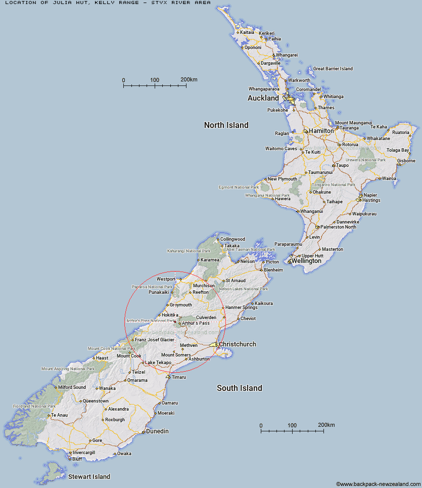
Topo Map showing location of Julia Hut
This information is sourced from DoC, LINZ and Openstreetmap. Some of the hut photos are mine and the rest are from DoC. I will be adding an upload feature soon so people can photos of .Julia Hut.
Basic info: standard six-bunk hut in the Hokitika area.
Latitude: -42.8976404611
Longitude: 171.424564903
Location: Kelly Range - Styx River area
Area: West Coast
Type of Hut: Standard
Tracks: Taipo River Track to Harman Pass|Harman Pass Route
Map: BV20 Topo Map | Road Map
Does this hut still exist? Have any more information? Contact
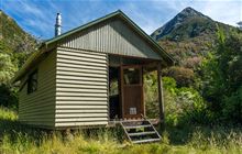
Image: DoC
Scroll down to see a topographical map and road map showing the location of Julia Hut
[ A ] [ B ] [ C ] [ D ] [ E ] [ F ] [ G ] [ H ] [ I ] [ J ] [ K ] [ L ] [ M ] [ N ] [ O ] [ P ] [ Q ] [ R ] [ S ] [ T ] [ U ] [ V ] [ W ] [ Y ] [ Z ]
Closest 20 Huts to Julia Hut
These are as the crow fliesOld Julia Hut 0.07km Mudflats Hut 5.24km Mid Taipo Hut 5.5km Campbell Bivouac 5.59km Waimakariri Falls Hut 5.6km Dunns Creek Hut 7km Carrington Hut 7.19km Newton Creek Hut 7.34km Harman Hut 8.73km Hunts Creek Hut 8.91km Crow Hut 9.09km Scottys Bivouac 10.12km Barker Hut 10.39km Park Morpeth Hut 10.64km Grassy Flat Hut 10.81km Top Olderog Bivouac 10.85km Lower Arahura Hut 11.1km Jacks Hut 11.2km Griffin Creek Hut 11.61km Lower Olderog Bivouac 11.71km Browning Range Bivouac 12.22km Rocky Creek Bivouac 12.42km Top Crawford Hut 12.59km Newton Range Bivouac 12.6km Anti Crow Hut 13.36km Dillon Hut 13.4km Dillons Homestead Hut 13.62km Mid Styx Hut 14.62km Upper Deception Hut 15.75km Carroll Hut 15.81km Goat Pass Hut 16.32km Greyneys Shelter 16.57km Mingha Bivouac 16.96km Crawford Junction Hut 16.99km Avoca Hut 17.31km Urquhart's Hut 17.51km Klondyke Shelter 17.74km Mt Brown Hut 18.56km Weka Burnet Bivouac 18.66km Boo Boo Hut 18.73km