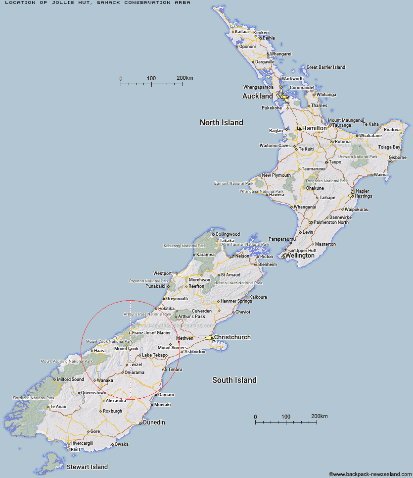
Topo Map showing location of Jollie Hut
This information is sourced from DoC, LINZ and Openstreetmap. Some of the hut photos are mine and the rest are from DoC. I will be adding an upload feature soon so people can photos of .Jollie Hut.
Basic info: Jollie Hut is in Gamack Conservation Area near Lake Pukaki.
Latitude: -43.852903395
Longitude: 170.19866848
Location: Gamack Conservation Area
Area: Canterbury
Type of Hut: Basic/bivvies
Map: BY16 Topo Map | Road Map
Does this hut still exist? Have any more information? Contact
Basic info: Jollie Hut is in Gamack Conservation Area near Lake Pukaki.
Latitude: -43.852903395
Longitude: 170.19866848
Location: Gamack Conservation Area
Area: Canterbury
Type of Hut: Basic/bivvies
Map: BY16 Topo Map | Road Map
Does this hut still exist? Have any more information? Contact
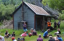
Image: DoC
Scroll down to see a topographical map and road map showing the location of Jollie Hut
[ A ] [ B ] [ C ] [ D ] [ E ] [ F ] [ G ] [ H ] [ I ] [ J ] [ K ] [ L ] [ M ] [ N ] [ O ] [ P ] [ Q ] [ R ] [ S ] [ T ] [ U ] [ V ] [ W ] [ Y ] [ Z ]
Closest 20 Huts to Jollie Hut
These are as the crow fliesGreen Point Hut 7.71km Maryburn Hut 11.06km Littles Hut 13.52km Whale Stream Hut 13.63km Waterfall Hut 16.47km Reardon Hut 16.93km Waterfall Hut 16.95km Telegraph Hut 17.38km Mueller Hut 18.17km Stocking Stream Shelter 19.01km Barron Saddle Hut 19.03km Kennedy Hut 19.09km Ryders Hut 19.64km Tin Hut 20.42km Sefton Bivvy 20.83km Grough Hut 22.08km Richardson Rock Bivouac 22.55km Erceg Hut 22.68km Station Hut 23.1km Middle Gorge Hut 23.29km Copland Shelter 23.42km Stony Stream Bivouac 24.02km Harpers Rock Bivouac 24.04km Caroline Hut 24.25km Birdcage Hut 24.43km Memorial Hut 24.53km Ball Hut 25.38km Dodger Hut 26.06km Liebig Hut 26.49km Douglas Rock Hut 26.5km Christmas Flat Hut 27.69km Onslow Hut (Steffan Memorial Hut) 28.43km Le Crens Hut 28.47km Horace Walker Hut 28.74km Empress Hut 29.38km Ribbonwood Hut 29.7km Plateau Hut 29.96km Cullers Hut 30.03km Haast Hut 30.04km Baikie Hut 30.32km