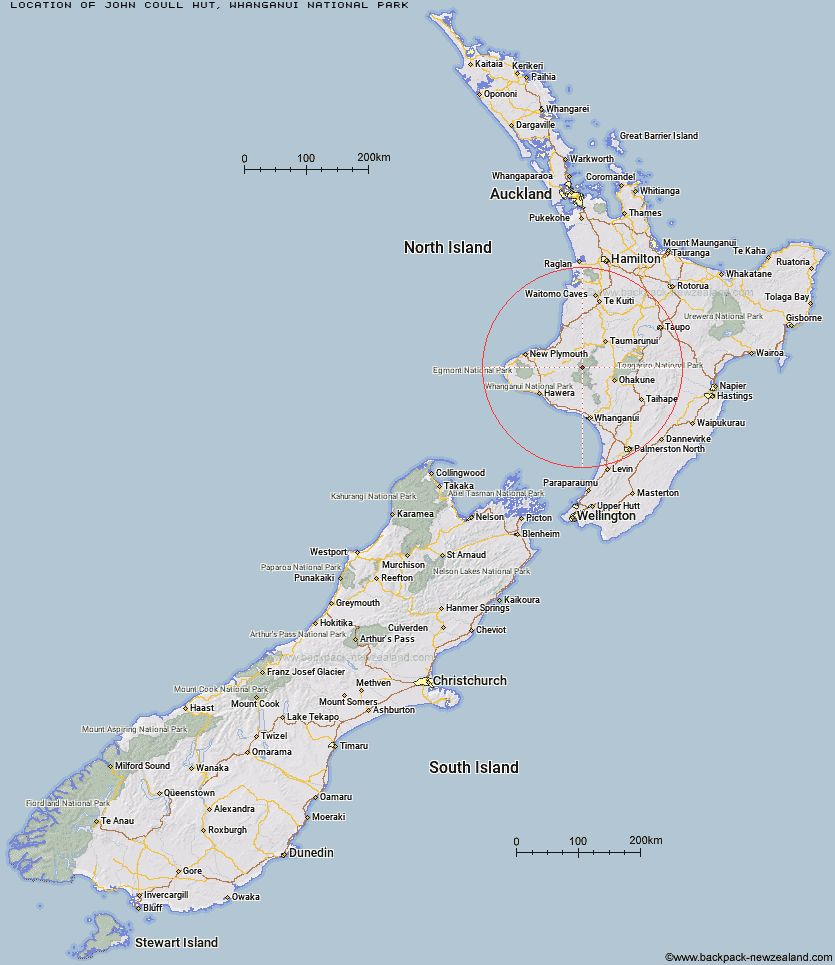
Topo Map showing location of John Coull Hut
This information is sourced from DoC, LINZ and Openstreetmap. Some of the hut photos are mine and the rest are from DoC. I will be adding an upload feature soon so people can photos of .John Coull Hut.
Basic info: 24-bunk hut located on the Whanganui Journey in the Whanganui area.
Latitude: -39.2333906677
Longitude: 174.913496687
Location: Whanganui National Park
Area: Manawatu/Whanganui
Type of Hut: Great Walk
Tracks: Whanganui Journey
Map: BJ32 Topo Map | Road Map
Does this hut still exist? Have any more information? Contact
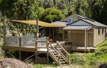
Image: DoC
Scroll down to see a topographical map and road map showing the location of John Coull Hut
[ A ] [ B ] [ C ] [ D ] [ E ] [ F ] [ G ] [ H ] [ I ] [ J ] [ K ] [ L ] [ M ] [ N ] [ O ] [ P ] [ Q ] [ R ] [ S ] [ T ] [ U ] [ V ] [ W ] [ Y ] [ Z ]
Closest 20 Huts to John Coull Hut
These are as the crow fliesPouri Hut 12.75km Omaru Hut 13.04km Tieke Kainga 13.46km Puketotara Hut 14.02km Ngapurua Hut 15.29km Puteore Hut 18.5km Ohuraiti Hut 22.45km Tahupo Hut 25.22km Trains Hut 31.59km Rerekapa Hut 37.17km Mangaturuturu Hut 51.14km Ten Man Hut 52km Whakapapaiti Hut 52.04km Lupton Hut 53.54km Blyth Hut 53.76km Mangaehuehu Hut 56.12km Downes hut 57.92km Whangaehu Hut 58.38km Mangatepopo Hut 59.7km Rangipo Hut 61.6km Ketetahi Shelter 65.25km Old Waihohonu Hut 65.45km Waihohonu Hut 66.07km Oturere Hut 67.36km Waingongoro Hut 69.77km Maketawa Hut 70.33km Kaiauai Shelter 71.37km Hooker Shelter 71.69km Syme Hut 73.44km Lake Dive Hut 74.28km Holly Hut 74.65km Hauhungaroa Hut 75.01km Pouakai Hut 75.45km Kahui Hut 77.68km Waiaua Gorge Hut 78.97km Zekes Hut 79.36km Waiweranui Trust Hut 83.26km Waihaha Hut 84.34km Westlawn Hut 84.7km Leitchs Hut 89.94km