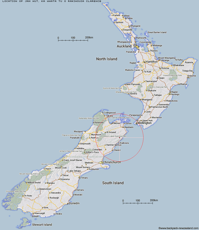
Topo Map showing location of Jam Hut
This information is sourced from DoC, LINZ and Openstreetmap. Some of the hut photos are mine and the rest are from DoC. I will be adding an upload feature soon so people can photos of .Jam Hut.
Basic info: standard 4-bunk hut in the South Marlborough area.
Latitude: -42.0955080483
Longitude: 173.715136364
Location: Ka Whata Tu o Rakihouia Clarence
Area: Marlborough
Type of Hut: Standard
Map: BS27 Topo Map | Road Map
Does this hut still exist? Have any more information? Contact
Basic info: standard 4-bunk hut in the South Marlborough area.
Latitude: -42.0955080483
Longitude: 173.715136364
Location: Ka Whata Tu o Rakihouia Clarence
Area: Marlborough
Type of Hut: Standard
Map: BS27 Topo Map | Road Map
Does this hut still exist? Have any more information? Contact
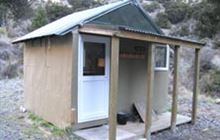
Image: DoC
Scroll down to see a topographical map and road map showing the location of Jam Hut
[ A ] [ B ] [ C ] [ D ] [ E ] [ F ] [ G ] [ H ] [ I ] [ J ] [ K ] [ L ] [ M ] [ N ] [ O ] [ P ] [ Q ] [ R ] [ S ] [ T ] [ U ] [ V ] [ W ] [ Y ] [ Z ]
Closest 20 Huts to Jam Hut
These are as the crow fliesHaycocks Bivouac 3.18km Hornby Bivvy 4.11km Snowgrass Hut 5.25km Ravine Hut 5.62km Dee Hut 11.05km Fidgit Bivouac 11.44km Gibson Hut 12.68km Goose Flat Hut 14.89km Mead Hut 15.7km Cabbage Tree Hut 15.79km Barratts Bivouac 16.84km Barratts Hut 16.96km Dubious Bivouac 18.45km Hapuku Hut 20.37km Cam Hut 20.86km Old Middlehurst Hut 21.3km Flynns 22.55km Swale Hut 22.74km Beechs Hut 23.43km Limestone Hut 23.43km Whernside Hut 24.08km Kowhai Hut 24.63km Zoo Hut 25.97km Mt Fyffe Hut 27.32km Seymour Hut 29.64km Warden Hut 30.56km Black Spur Historic Hut 31.14km Isolation Hut 31.19km Tent Poles Hut 31.38km Penk Hut 34.41km Lake McRae Hut 34.65km Kahutara Bivouac 35.75km Top Whare 36.65km Burnt Yards Hut 37.26km Lake Alexander Hut 38.74km Munroe Hut 39.2km Alfred Hut 39.52km Blue Mountain Hut 41.42km Junction Hut 42.71km Omaka Bivouac 42.81km