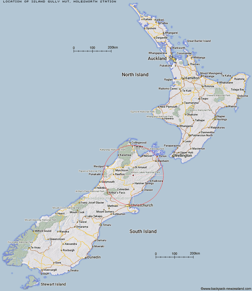
Topo Map showing location of Island Gully Hut
This information is sourced from DoC, LINZ and Openstreetmap. Some of the hut photos are mine and the rest are from DoC. I will be adding an upload feature soon so people can photos of .Island Gully Hut.
Basic info: standard 4-bunk hut in the South Marlborough area.
Latitude: -42.1463290576
Longitude: 172.826067174
Location: Molesworth Station
Area: Marlborough
Type of Hut: Standard
Map: BS25 Topo Map | Road Map
Does this hut still exist? Have any more information? Contact
Basic info: standard 4-bunk hut in the South Marlborough area.
Latitude: -42.1463290576
Longitude: 172.826067174
Location: Molesworth Station
Area: Marlborough
Type of Hut: Standard
Map: BS25 Topo Map | Road Map
Does this hut still exist? Have any more information? Contact
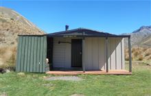
Image: DoC
Scroll down to see a topographical map and road map showing the location of Island Gully Hut
[ A ] [ B ] [ C ] [ D ] [ E ] [ F ] [ G ] [ H ] [ I ] [ J ] [ K ] [ L ] [ M ] [ N ] [ O ] [ P ] [ Q ] [ R ] [ S ] [ T ] [ U ] [ V ] [ W ] [ Y ] [ Z ]
Closest 20 Huts to Island Gully Hut
These are as the crow fliesSedgemere Sleepout 6.2km Paske Hut 7.06km Begley Hut 12.68km Caroline Creek Bivouac 13.71km Upper Travers Hut 15.35km Connors Creek Hut 16.41km Blue Lake Hut 17.17km Upper D'Urville Hut 18.67km Red Gate Hut 18.76km Fowlers Hut 19.25km West Sabine Hut 19.34km John Tait Hut 19.66km Severn Hut 19.76km Cupola Hut 20.87km Yarra Hut 21.18km George Lyon Hut 21.29km Lake Guyon Hut 21.42km East Matakitaki Hut 22.72km Stanley Vale Hut 23.29km Guide Hut 24.13km Acheron Hut 24.25km Morgan Hut 24.3km Hopeless Hut 24.68km Downie Hut 24.89km Lees Creek Hut 25.7km Christopher Hut 26.68km Branch Bivouac 26.76km Christopher Cullers Hut 26.83km Mount Misery Hut 26.86km Top Leatham Hut 28.59km Saxton Hut 28.75km Matakitaki Base Hut 29.17km Bobs Hut 29.3km Mole Hut 29.38km Angelus Hut 29.38km Half Moon Hut 29.66km Sabine Hut 29.77km Lakehead Hut 30.1km D'Urville Hut 30.61km Coldwater Hut 30.69km