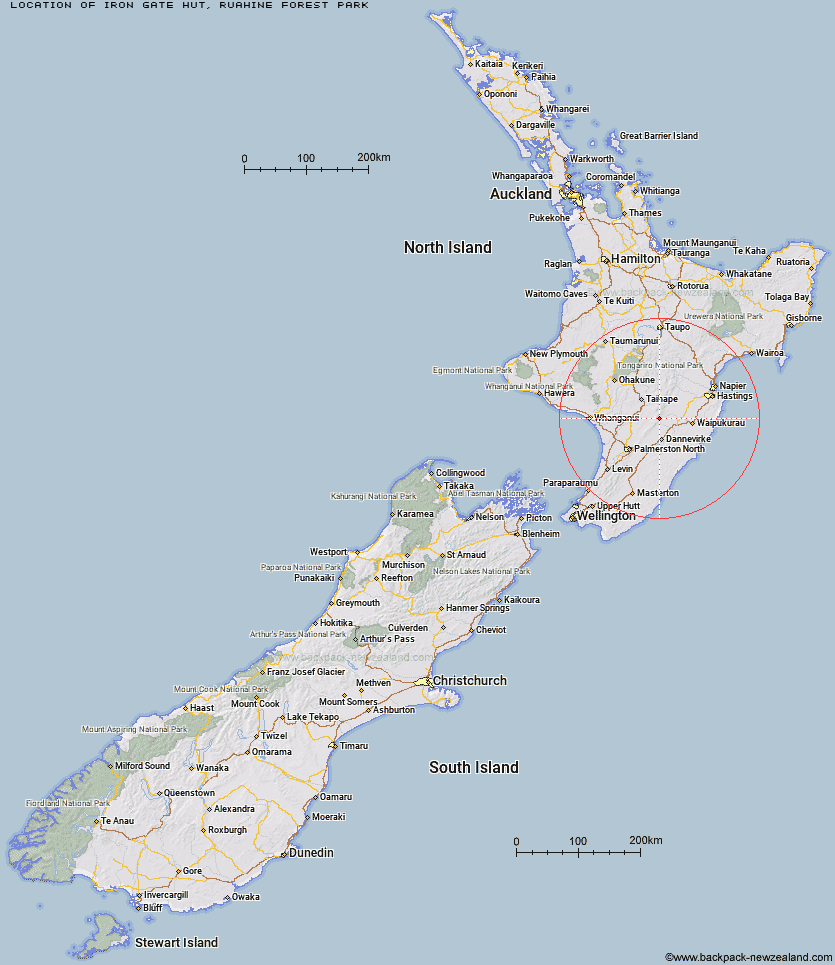
Topo Map showing location of Iron Gate Hut
This information is sourced from DoC, LINZ and Openstreetmap. Some of the hut photos are mine and the rest are from DoC. I will be adding an upload feature soon so people can photos of .Iron Gate Hut.
Basic info: standard seven-bunk hut in the Manawatu.
Latitude: -39.9269477259
Longitude: 176.057060051
Location: Ruahine Forest Park
Area: Manawatu/Whanganui
Type of Hut: Standard
Tracks: Iron Gate Hut Track|Renfrew Roadend to Table Flat Roadend|Table Flat - Kashmir Roadend West-East crossing
Map: BL36 Topo Map | Road Map
Does this hut still exist? Have any more information? Contact
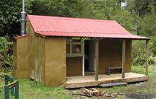
Image: DoC
Scroll down to see a topographical map and road map showing the location of Iron Gate Hut
[ A ] [ B ] [ C ] [ D ] [ E ] [ F ] [ G ] [ H ] [ I ] [ J ] [ K ] [ L ] [ M ] [ N ] [ O ] [ P ] [ Q ] [ R ] [ S ] [ T ] [ U ] [ V ] [ W ] [ Y ] [ Z ]
Closest 20 Huts to Iron Gate Hut
These are as the crow fliesTriangle Hut 2.96km Alice Nash Memorial Heritage Lodge 4.57km Rangiwahia Hut 5.2km Top Gorge Hut 6.06km Longview Hut 6.19km Toka Bivouac 6.39km Howletts Hut 6.42km Daphne Hut 7.6km Pourangaki Hut 7.86km Awatere Hut 8.5km Kelly Knight Hut 8.55km Leon Kinvig Hut 8.73km Tarn Bivouac 8.85km Makaretu Hut 9.87km Happy Daze Hut 10.62km Purity Hut 11.86km Waterfall Hut 11.93km Hinerua Hut 12.03km Ngamoko Hut 12.06km Piripiri Hut 12.94km Smiths Stream Hut 12.98km Mid Pohangina Hut 14.31km Waikamaka Hut 14.4km Cattle Creek Hut 15.47km McKinnon Hut 16.47km Waipawa Forks Hut 17.46km Stanfield Hut 17.93km Crow Hut 17.95km Sunrise Hut 18.17km Kawhatau Base 18.58km Top Maropea Hut 19.02km Triplex Hut 19.12km Wakelings Hut 20.14km Traverse (A Frame) Hut 20.37km Diggers Hut 21.18km Gold Creek Hut 21.91km Maropea Forks Hut 23km Forks Hut 23.05km Te Ekaou Hut 23.16km Norris Hut 23.44km