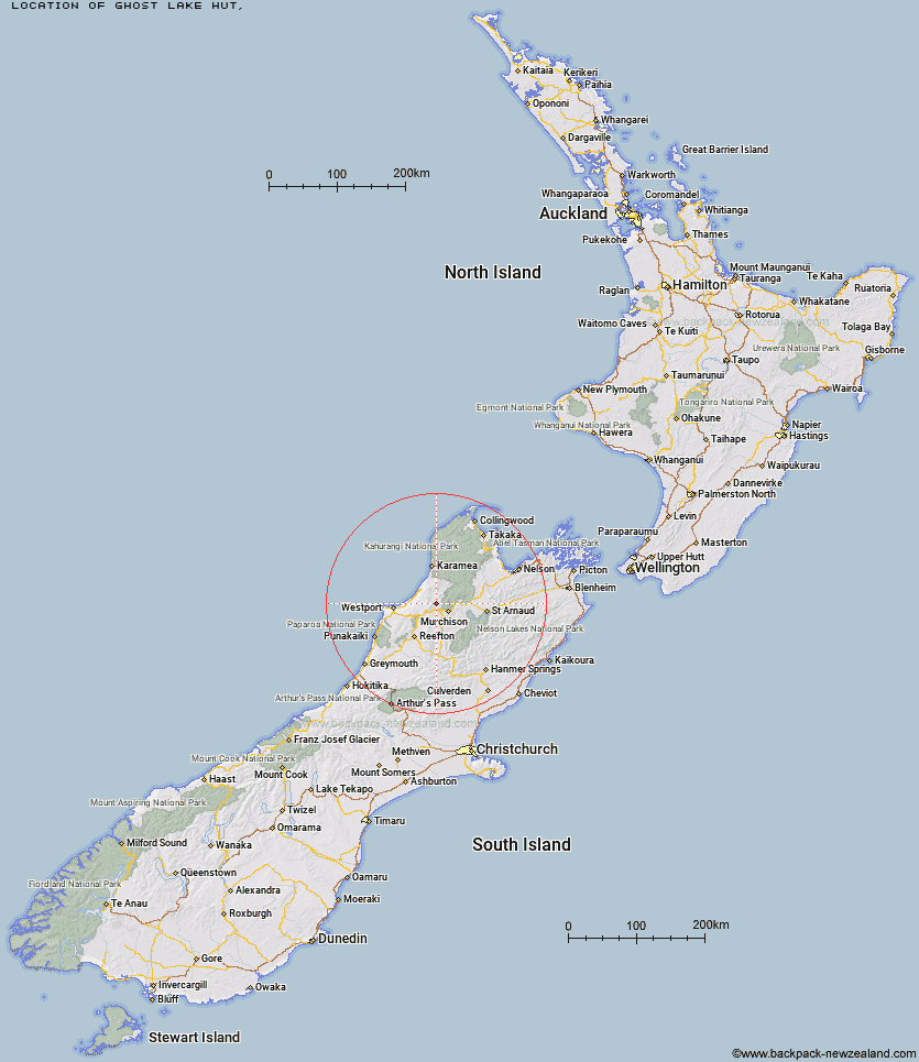
Topo Map showing location of Ghost Lake Hut
This information is sourced from DoC, LINZ and Openstreetmap. Some of the hut photos are mine and the rest are from DoC. I will be adding an upload feature soon so people can photos of .Ghost Lake Hut.
Latitude: -41.7000258299
Longitude: 172.158958489
Location:
Type of Hut:
Map: Topo Map | Road Map
Does this hut still exist? Have any more information? Contact
Latitude: -41.7000258299
Longitude: 172.158958489
Location:
Type of Hut:
Map: Topo Map | Road Map
Does this hut still exist? Have any more information? Contact
Scroll down to see a topographical map and road map showing the location of Ghost Lake Hut
[ A ] [ B ] [ C ] [ D ] [ E ] [ F ] [ G ] [ H ] [ I ] [ J ] [ K ] [ L ] [ M ] [ N ] [ O ] [ P ] [ Q ] [ R ] [ S ] [ T ] [ U ] [ V ] [ W ] [ Y ] [ Z ]
Closest 20 Huts to Ghost Lake Hut
These are as the crow fliesStern Valley Hut 5.23km Lyell Saddle Hut 5.62km Goat Creek Hut 10.98km Lake Matiri Hut 15.04km Poor Pete's Hut 16.59km Mokihinui Forks Hut 16.96km Specimen Point Hut 17.28km Larrikin Creek Hut 20.33km McConchies Hut 21.16km Johnson Hut 27.64km Hurricane Hut 28.42km Branch Creek Hut 35.21km Stag Flat Shelter 35.62km Helicopter Flat Hut 35.78km Taipo Hut 35.97km Wangapeka Bivouac 36.94km Cecil Kings Hut 37.17km Kings Creek Hut 37.4km Trevor Carter Hut 38.7km Granity Pass Hut 38.8km Stone Hut 38.85km Belltown Manunui Hut 39.48km Wheel Creek Hut 41.3km Tiraumea Hut 41.98km Kākāpō Hut 42.61km Kiwi Saddle Hut 42.91km Mole Hut 44.9km Thor Hut 45.04km Matakitaki Base Hut 46.08km John Reid Hut 46.41km D'Urville Hut 46.41km Kirwans Hut 46.49km Buckland Peaks Hut 48.03km Venus Hut 48.59km Sabine Hut 48.73km Nardoo Hut 49.52km Mount Misery Hut 49.75km Morgan Hut 50.16km Montgomerie Hut 51.74km Speargrass Hut 52.03km