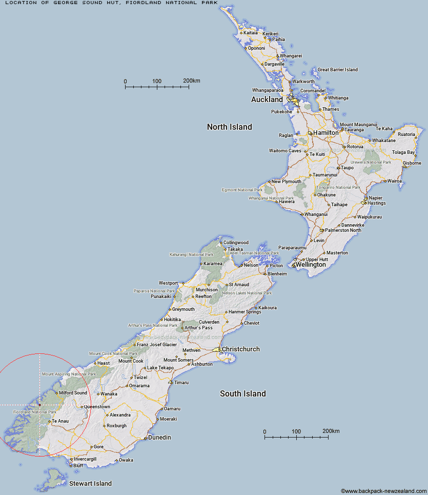
Topo Map showing location of George Sound Hut
This information is sourced from DoC, LINZ and Openstreetmap. Some of the hut photos are mine and the rest are from DoC. I will be adding an upload feature soon so people can photos of .George Sound Hut.
Basic info: standard eight-bunk hut in western Fiordland.
Latitude: -44.9838889366
Longitude: 167.440117279
Location: Fiordland National Park
Area: Fiordland
Type of Hut: Standard
Tracks: George Sound Route
Map: CC07 Topo Map | Road Map
Does this hut still exist? Have any more information? Contact
Basic info: standard eight-bunk hut in western Fiordland.
Latitude: -44.9838889366
Longitude: 167.440117279
Location: Fiordland National Park
Area: Fiordland
Type of Hut: Standard
Tracks: George Sound Route
Map: CC07 Topo Map | Road Map
Does this hut still exist? Have any more information? Contact
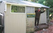
Image: DoC
Scroll down to see a topographical map and road map showing the location of George Sound Hut
[ A ] [ B ] [ C ] [ D ] [ E ] [ F ] [ G ] [ H ] [ I ] [ J ] [ K ] [ L ] [ M ] [ N ] [ O ] [ P ] [ Q ] [ R ] [ S ] [ T ] [ U ] [ V ] [ W ] [ Y ] [ Z ]
Closest 20 Huts to George Sound Hut
These are as the crow fliesGeorge Sound Hut 0km Lake Thomson Hut 8.9km Lake Hankinson Hut 12.03km Caswell Sound Hut 12.54km Junction Burn Hut 19.13km Glaisnock Hut 20.24km Robin Saddle Hut 24.56km Worsley Hut 31.29km Quintin Lodge 32.67km Pompolona Lodge 32.74km Bus Stop Shelter 32.78km Mintaro Hut 33.14km Prairie Shelter 33.15km Mackinnon Pass Shelter 33.24km Andersons Cascade Shelter 33.72km Hirere Shelter 33.99km Dumpling Hut 35.07km Clinton Hut 37.86km Glade House 39.07km Boatshed Shelter 39.5km Boatshed Hut 39.53km Deas Cove Hut 43.31km Giant Gate Shelter 44.74km Hanging Valley Shelter 44.99km Forest Burn Shelter 46.27km Iris Burn Hut 46.48km Luxmore Hut 46.79km Rocky Point Hut 47.73km Sandfly Point Shelter 49.33km Brod Bay Shelter and Campsite 50.27km Homer Hut 50.44km Stantley Burn Hut 50.94km Freeman Burn Hut 50.98km The Gut Hut 51.39km Phil's Bivvy 54.32km Gill's Bivvy 54.45km Army Hut 55.35km Forks Hut 55.9km The Divide Shelter 56.21km McKellar Lodge 56.86km