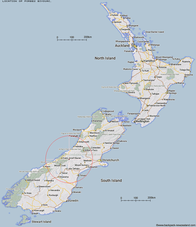
Topo Map showing location of Forbes Bivouac
This information is sourced from DoC, LINZ and Openstreetmap. Some of the hut photos are mine and the rest are from DoC. I will be adding an upload feature soon so people can photos of .Forbes Bivouac.
Latitude: -43.4648712218
Longitude: 170.648070844
Location:
Type of Hut:
Map: Topo Map | Road Map
Does this hut still exist? Have any more information? Contact
Latitude: -43.4648712218
Longitude: 170.648070844
Location:
Type of Hut:
Map: Topo Map | Road Map
Does this hut still exist? Have any more information? Contact
Scroll down to see a topographical map and road map showing the location of Forbes Bivouac
[ A ] [ B ] [ C ] [ D ] [ E ] [ F ] [ G ] [ H ] [ I ] [ J ] [ K ] [ L ] [ M ] [ N ] [ O ] [ P ] [ Q ] [ R ] [ S ] [ T ] [ U ] [ V ] [ W ] [ Y ] [ Z ]
Closest 20 Huts to Forbes Bivouac
These are as the crow fliesMurphys Bivvy 2.38km Carneys Bivvy's 3.67km Mistake Flats Hut 4.12km Curtis Memorial Hut 5.38km Saint Winifreds Hut 6.02km Growler Hut 8.93km Godley Hut 11.24km Scone Hut 11.78km Watchdog Hut 12.97km Macaulay Hut 13.35km McCoy Hut 14.1km Red Stag Hut 14.42km Eade Memorial Hut 14.71km Black Mountain Hut 16.28km Erewhon Station Hut 16.31km Top Butler Hut 17.48km Dog Kennel Bivouac 18.6km Nolans Hut 18.64km Lawrence Hut 19.73km Butler Junction Hut 19.91km Rankin Hut 20.65km Crooked Spur Hut 21.04km Murchison Hut 21.32km Hermitage Hut 22.14km Whymper Hut 22.47km Stony Stream Hut 22.66km Stan's Hut 23.26km Kelman Hut 23.93km Tasman Saddle Hut 25.29km Angus Hut 25.3km Lawrence Bivouac 25.42km Potts Hut 26.19km Stone Hut 26.55km Hunters Hut 27.79km Lyell Hut 28.05km Ribbonwood Hut 29.16km Royal Hut 29.84km Spencer Rock Bivouac 30.69km Top Hut 31.13km Cameron Hut 31.8km