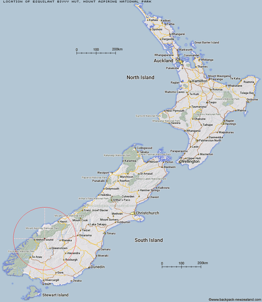
Topo Map showing location of Esquilant Bivvy Hut
This information is sourced from DoC, LINZ and Openstreetmap. Some of the hut photos are mine and the rest are from DoC. I will be adding an upload feature soon so people can photos of .Esquilant Bivvy Hut.
Basic info: This is an NZAC basic six-bunk hut in the Queenstown/Wakatipu area.
Latitude: -44.6153984436
Longitude: 168.407036791
Location: Mount Aspiring National Park
Area: Otago
Type of Hut: Basic/bivvies
Map: CA10 Topo Map | Road Map
Does this hut still exist? Have any more information? Contact
Basic info: This is an NZAC basic six-bunk hut in the Queenstown/Wakatipu area.
Latitude: -44.6153984436
Longitude: 168.407036791
Location: Mount Aspiring National Park
Area: Otago
Type of Hut: Basic/bivvies
Map: CA10 Topo Map | Road Map
Does this hut still exist? Have any more information? Contact
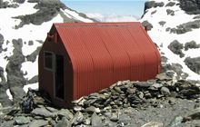
Image: DoC
Scroll down to see a topographical map and road map showing the location of Esquilant Bivvy Hut
[ A ] [ B ] [ C ] [ D ] [ E ] [ F ] [ G ] [ H ] [ I ] [ J ] [ K ] [ L ] [ M ] [ N ] [ O ] [ P ] [ Q ] [ R ] [ S ] [ T ] [ U ] [ V ] [ W ] [ Y ] [ Z ]
Closest 20 Huts to Esquilant Bivvy Hut
These are as the crow fliesEarnslaw Hut 3.28km Twenty Five Mile Hut 5.75km Daleys Flat Hut 7.9km Shelter Rock Hut 10.24km Routeburn Shelter 15.37km Dart Hut 15.66km Lochnagar Hut 16.98km Routeburn Flats Hut 19.49km Hundred Mile Hut 20.01km Sixteen Mile Huts 20.28km Routeburn Falls Hut 20.5km Routeburn Falls Lodge 20.56km Tummel Burn Hut 21.44km Lake Alabaster Hut 22.21km Sunshine Hut 22.94km Hidden Falls Hut 23.17km Kay Creek Hut 24.05km McIntosh Hut 24.36km Olivine Hut 24.48km Cascade Hut 24.78km Ballarat Hut - Flood Burn 24.85km McIntyre's Hut 24.88km Lake Mackenzie Hut 25.03km Lake Mackenzie Lodge 25.14km Aspiring Hut 25.27km Jean Hut 26.69km Heather Jock Hut 26.84km Shiel Burn Hut 27km Wallers Hut 27.06km Archie's Hut - Copper Creek 27.11km Bonnie Jean Hut 27.31km Arawhata Rock Bivouac 27.52km Bullendale Hut 28.46km Dynamo Hut 28.89km Liverpool Hut 28.96km Kelly's Hut 29km Raspberry Creek Shelter 29.27km McKerrow Island Hut 29.29km Upper Caples Hut 29.31km Polnoon Hut 29.54km