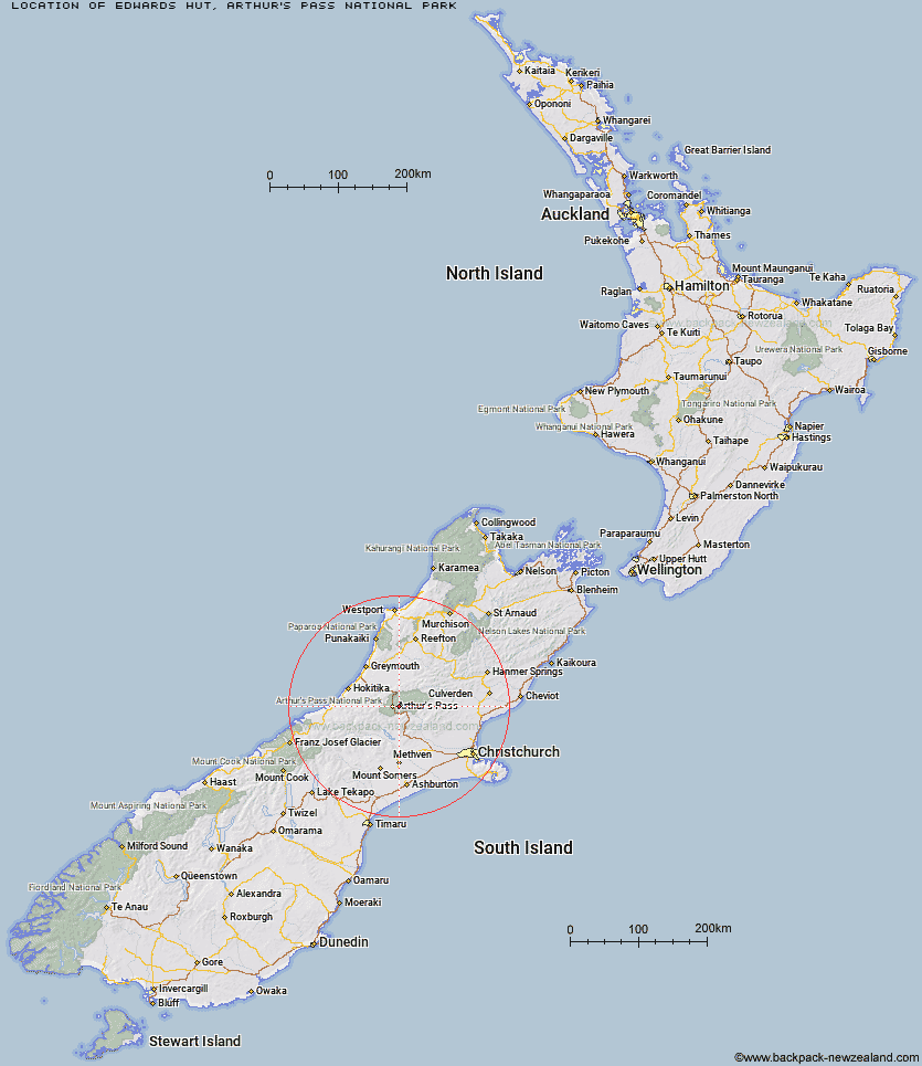
Topo Map showing location of Edwards Hut
This information is sourced from DoC, LINZ and Openstreetmap. Some of the hut photos are mine and the rest are from DoC. I will be adding an upload feature soon so people can photos of .Edwards Hut.
Basic info: serviced 16-bunk hut in the North Canterbury and Arthur's Pass area.
Latitude: -42.9418353253
Longitude: 171.648015504
Location: Arthur's Pass National Park
Area: Canterbury
Type of Hut: Serviced
Tracks: Edwards - Hawdon Route|Edwards - Otehake Route
Map: BV20 Topo Map | Road Map
Does this hut still exist? Have any more information? Contact
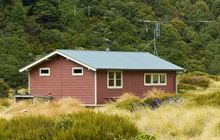
Image: DoC
Scroll down to see a topographical map and road map showing the location of Edwards Hut
[ A ] [ B ] [ C ] [ D ] [ E ] [ F ] [ G ] [ H ] [ I ] [ J ] [ K ] [ L ] [ M ] [ N ] [ O ] [ P ] [ Q ] [ R ] [ S ] [ T ] [ U ] [ V ] [ W ] [ Y ] [ Z ]
Closest 20 Huts to Edwards Hut
These are as the crow fliesMingha Bivouac 2.58km Sudden Valley Bivouac 4.69km Goat Pass Hut 4.86km Greyneys Shelter 6.66km Upper Deception Hut 6.89km Jacks Hut 7.67km Hawdon Hut 7.69km Klondyke Shelter 8.25km Hawdon Shelter 9.55km Crow Hut 10.66km Otehake Hut 10.67km Bealey Hut 10.68km East Hawdon Bivouac 11.43km Bealey Spur Hut 11.97km Riversdale Hut 12.48km Anti Crow Hut 12.84km Lagoon Saddle Hut 13.13km Andrews Shelter 13.15km Lagoon Saddle A Frame Hut 13.15km Waimakariri Falls Hut 13.33km Worsley Bivouac 14.9km Pfeifer Bivouac 15.47km Koropuku Hut 16.07km Carrington Hut 16.37km Hunts Creek Hut 16.39km Poulter Hut 16.72km Poulter Bivouac 17.28km Cass Saddle Hut 17.62km West Harper Hut 17.88km Carroll Hut 18.55km Trust/Poulter Hut 18.59km Old Julia Hut 18.77km Julia Hut 18.85km Mid Taipo Hut 19.54km Hamilton Hut 20.91km Minchin Bivouac 21.03km Barker Hut 21.04km Turnbull Bivouac 21.26km Townsend Hut 21.42km Dunns Creek Hut 21.49km