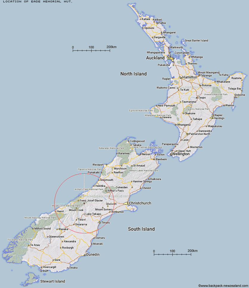
Topo Map showing location of Eade Memorial Hut
This information is sourced from DoC, LINZ and Openstreetmap. Some of the hut photos are mine and the rest are from DoC. I will be adding an upload feature soon so people can photos of .Eade Memorial Hut.
Latitude: -43.519371959
Longitude: 170.481904751
Location:
Type of Hut:
Map: Topo Map | Road Map
Does this hut still exist? Have any more information? Contact
Latitude: -43.519371959
Longitude: 170.481904751
Location:
Type of Hut:
Map: Topo Map | Road Map
Does this hut still exist? Have any more information? Contact
Scroll down to see a topographical map and road map showing the location of Eade Memorial Hut
[ A ] [ B ] [ C ] [ D ] [ E ] [ F ] [ G ] [ H ] [ I ] [ J ] [ K ] [ L ] [ M ] [ N ] [ O ] [ P ] [ Q ] [ R ] [ S ] [ T ] [ U ] [ V ] [ W ] [ Y ] [ Z ]
Closest 20 Huts to Eade Memorial Hut
These are as the crow fliesRed Stag Hut 2.84km Godley Hut 4.91km Murchison Hut 7.06km Rankin Hut 9.24km Kelman Hut 9.75km Tasman Saddle Hut 11.31km Top Butler Hut 11.5km Macaulay Hut 11.92km Whymper Hut 12.38km Butler Junction Hut 13.56km Forbes Bivouac 14.71km Carneys Bivvy's 14.79km Angus Hut 15.04km Murphys Bivvy 16.78km Onslow Hut (Steffan Memorial Hut) 17.3km Scone Hut 17.45km Liebig Hut 18.4km Mistake Flats Hut 18.83km Nolans Hut 19.01km Memorial Hut 19.29km Stan's Hut 19.32km Spencer Rock Bivouac 19.42km Birdcage Hut 19.53km Stony Stream Hut 19.63km Saint Winifreds Hut 19.83km Curtis Memorial Hut 20.03km Centennial Hut 20.03km Growler Hut 20.73km Ribbonwood Hut 20.96km Almer Hut 22.61km Haast Hut 24.05km Pioneer Hut 24.13km Plateau Hut 25.05km Tin Hut 25.31km Ball Hut 26.21km Hende's Hut 26.36km Castle Rocks Hut 26.46km Middle Gorge Hut 27.36km Crooked Spur Hut 27.38km Dog Kennel Bivouac 27.41km