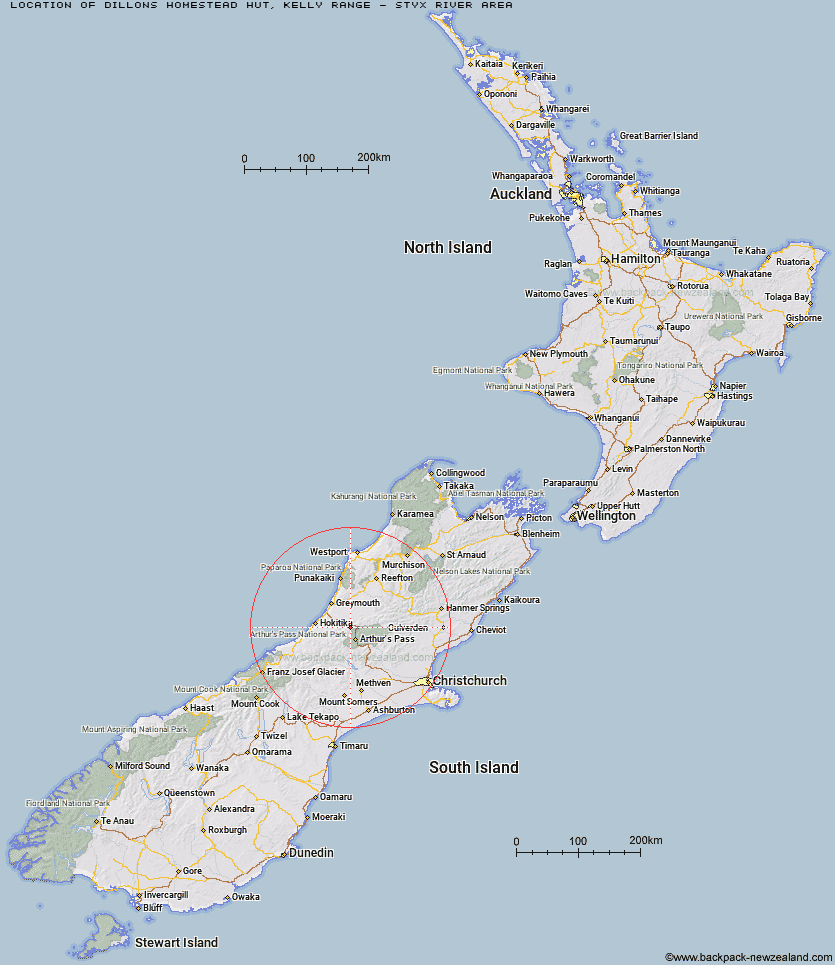
Topo Map showing location of Dillons Homestead Hut
This information is sourced from DoC, LINZ and Openstreetmap. Some of the hut photos are mine and the rest are from DoC. I will be adding an upload feature soon so people can photos of .Dillons Homestead Hut.
Basic info: basic 10-bunk hut in the Hokitika area.
Latitude: -42.7834727137
Longitude: 171.485048818
Location: Kelly Range - Styx River area
Area: West Coast
Type of Hut: Basic/bivvies
Tracks: Taipo River Track to Harman Pass|Harman Pass Route
Map: BV20 Topo Map | Road Map
Does this hut still exist? Have any more information? Contact
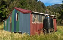
Image: DoC
Scroll down to see a topographical map and road map showing the location of Dillons Homestead Hut
[ A ] [ B ] [ C ] [ D ] [ E ] [ F ] [ G ] [ H ] [ I ] [ J ] [ K ] [ L ] [ M ] [ N ] [ O ] [ P ] [ Q ] [ R ] [ S ] [ T ] [ U ] [ V ] [ W ] [ Y ] [ Z ]
Closest 20 Huts to Dillons Homestead Hut
These are as the crow fliesDillon Hut 0.33km Carroll Hut 5.53km Rocky Creek Bivouac 6.19km Scottys Bivouac 6.5km Hunts Creek Hut 6.51km Dunns Creek Hut 7.33km Mid Taipo Hut 8.15km Griffin Creek Hut 8.5km Camp Creek Hut 10.63km Newton Creek Hut 10.86km Top Olderog Bivouac 12.57km Julia Hut 13.62km Old Julia Hut 13.62km Mudflats Hut 13.89km Jacko Flat Hut 14.57km Pfeifer Bivouac 14.87km Waimakariri Falls Hut 14.92km Upper Deception Hut 15.53km Lower Olderog Bivouac 15.81km Jacks Hut 16.28km Campbell Bivouac 16.56km Lower Arahura Hut 17.08km Goat Pass Hut 17.39km Crow Hut 17.98km Top Crooked Hut 18.98km Mingha Bivouac 19.48km Carrington Hut 19.84km Grassy Flat Hut 19.85km Harman Hut 20.16km Otehake Hut 20.16km Newton Range Bivouac 20.38km Koropuku Hut 20.61km Kiwi Hut 21.29km Browning Range Bivouac 21.84km Edwards Hut 22.06km Lake Morgan Hut 22.67km Cone Creek Hut 23.18km Mid Styx Hut 23.2km Poulter Bivouac 23.59km Top Crawford Hut 23.83km