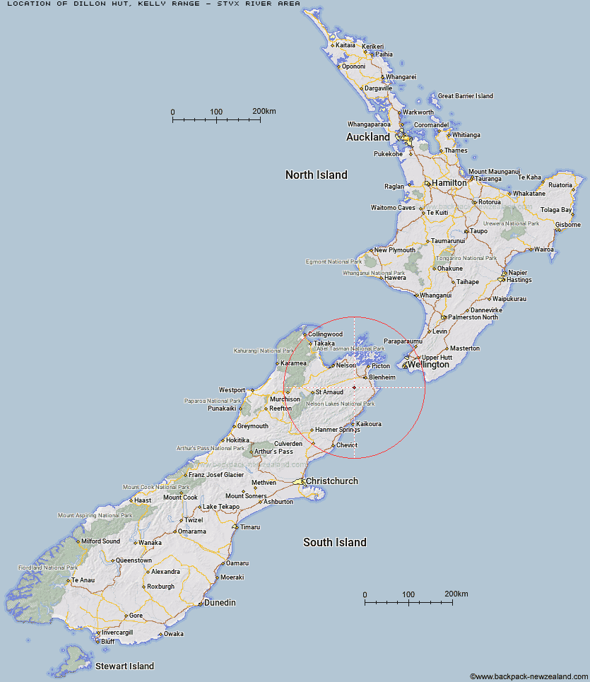
Topo Map showing location of Dillon Hut
This information is sourced from DoC, LINZ and Openstreetmap. Some of the hut photos are mine and the rest are from DoC. I will be adding an upload feature soon so people can photos of .Dillon Hut.
Basic info: standard 10-bunk hut in the Hokitika area.
Latitude: -41.7080655368
Longitude: 173.725964607
Location: Kelly Range - Styx River area
Area: West Coast
Type of Hut: Standard
Tracks: Taipo River Track to Harman Pass|Harman Pass Route
Map: BR28 Topo Map | Road Map
Does this hut still exist? Have any more information? Contact
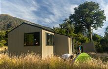
Image: DoC
Scroll down to see a topographical map and road map showing the location of Dillon Hut
[ A ] [ B ] [ C ] [ D ] [ E ] [ F ] [ G ] [ H ] [ I ] [ J ] [ K ] [ L ] [ M ] [ N ] [ O ] [ P ] [ Q ] [ R ] [ S ] [ T ] [ U ] [ V ] [ W ] [ Y ] [ Z ]
Closest 20 Huts to Dillon Hut
These are as the crow fliesOmaka Bivouac 2.22km McNaughts Hut 3.51km Ramshead Hut 5.98km Beehive Hut 6.07km Lake Alexander Hut 7.03km Black Birch Bivouac 7.93km Penk Hut 9.44km Tinpot Hut 14.43km Flynns 21.63km Cam Hut 22.37km Swale Hut 25.17km Beechs Hut 25.32km Chimney 26.93km Top Whare 28.92km Zoo Hut 29.17km Mead Hut 30.08km Isolation Hut 30.23km Whernside Hut 31.09km Fosters Hut 31.62km Dee Hut 32.45km Gosling Hut 32.53km Cabbage Tree Hut 33.21km Old Middlehurst Hut 33.39km Mt Sunday Bivouac 33.47km Turkeys Nest Bivouac 33.81km Gibson Hut 34.07km Devils Creek Hut 34.75km Fishtail Hut 35.15km Hidden Hut 35.87km Lake Chalice Hut 37.15km Blue Mountain Hut 37.5km Mt Fell Hut 38.02km Snowgrass Hut 38.23km Richmond Saddle Hut 38.6km Hornby Bivvy 39.99km Boulder Forks Hut 40.17km Ravine Hut 41.87km Old Man Hut 42.97km Jam Hut 43.09km Mid Goulter Hut 43.15km