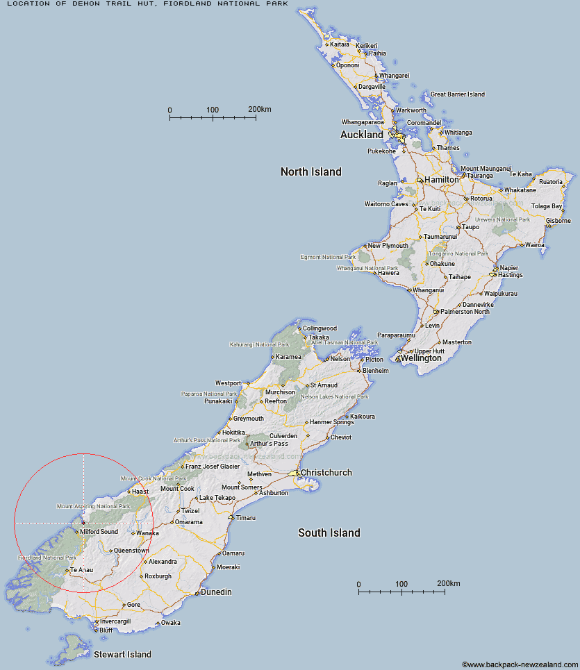
Topo Map showing location of Demon Trail Hut
This information is sourced from DoC, LINZ and Openstreetmap. Some of the hut photos are mine and the rest are from DoC. I will be adding an upload feature soon so people can photos of .Demon Trail Hut.
Basic info: serviced 12-bunk hut in northern Fiordland.
Latitude: -44.4941973125
Longitude: 168.073357087
Location: Fiordland National Park
Area: Fiordland
Type of Hut: Serviced
Tracks: Hollyford Track
Map: CA09 Topo Map | Road Map
Does this hut still exist? Have any more information? Contact
Basic info: serviced 12-bunk hut in northern Fiordland.
Latitude: -44.4941973125
Longitude: 168.073357087
Location: Fiordland National Park
Area: Fiordland
Type of Hut: Serviced
Tracks: Hollyford Track
Map: CA09 Topo Map | Road Map
Does this hut still exist? Have any more information? Contact
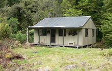
Image: DoC
Scroll down to see a topographical map and road map showing the location of Demon Trail Hut
[ A ] [ B ] [ C ] [ D ] [ E ] [ F ] [ G ] [ H ] [ I ] [ J ] [ K ] [ L ] [ M ] [ N ] [ O ] [ P ] [ Q ] [ R ] [ S ] [ T ] [ U ] [ V ] [ W ] [ Y ] [ Z ]
Closest 20 Huts to Demon Trail Hut
These are as the crow fliesMcKerrow Island Hut 2.75km Lake Alabaster Hut 8.03km Hokuri Hut 8.24km Kaipo Hut 10.3km Olivine Hut 12.48km Pawnbroker Rock 12.7km Turners Bivouac 14.63km Hidden Falls Hut 14.75km Sunshine Hut 15.43km Martins Bay Hut 18.61km Big Bay Hut 21.96km Daleys Flat Hut 24.61km Sandfly Point Shelter 25.14km Gill's Bivvy 26.93km Routeburn Falls Hut 27.63km Routeburn Falls Lodge 27.65km Phil's Bivvy 27.68km Routeburn Flats Hut 28.08km Giant Gate Shelter 29.44km Esquilant Bivvy Hut 29.68km Routeburn Shelter 29.79km Homer Hut 30.88km Lake Mackenzie Hut 31.41km Lake Mackenzie Lodge 31.54km Earnslaw Hut 32.87km Boatshed Hut 34.57km Boatshed Shelter 34.59km Shelter Rock Hut 35.26km Twenty Five Mile Hut 35.42km Gorge River Hut 35.78km Lake Howden Hut 36.07km Kay Creek Hut 36.57km The Divide Shelter 36.93km Dart Hut 38.28km Dumpling Hut 39.04km Upper Caples Hut 40.63km Andersons Cascade Shelter 40.9km Spoon Hut 41.15km Mackinnon Pass Shelter 41.6km Quintin Lodge 41.63km