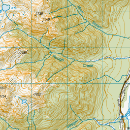
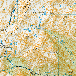
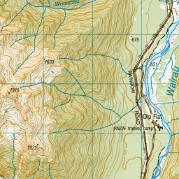
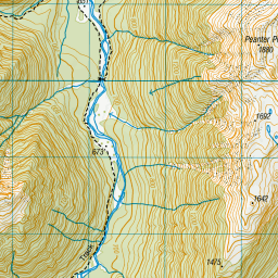
Topo Map showing location of Coldwater Hut
This information is sourced from DoC, LINZ and Openstreetmap. Some of the hut photos are mine and the rest are from DoC. I will be adding an upload feature soon so people can photos of .Coldwater Hut.
Basic info: Coldwater Hut provides a good overnight tramp for families with children and those new to tramping. It can also be reached by water taxi.
Latitude: -41.8704230631
Longitude: 172.817062362
Location: Nelson Lakes National Park
Area: Nelson/Tasman
Type of Hut: Standard
Tracks: Lake Rotoiti Circuit|Travers-Sabine Circuit
Map: BS24 Topo Map | Road Map
Does this hut still exist? Have any more information? Contact
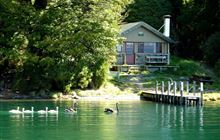
Image: DoC
Scroll down to see a topographical map and road map showing the location of Coldwater Hut
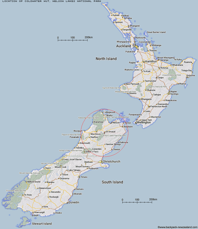
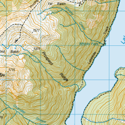
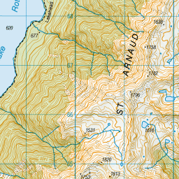
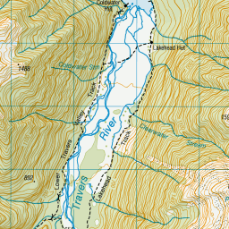

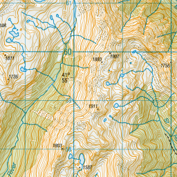
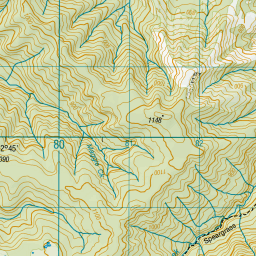
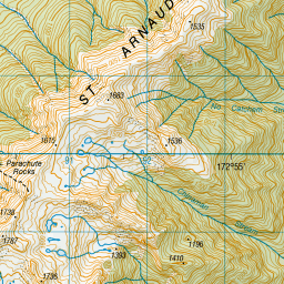
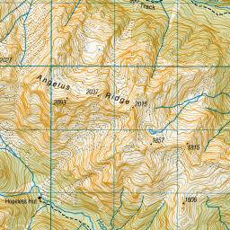
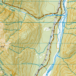
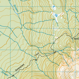
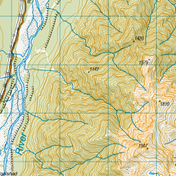
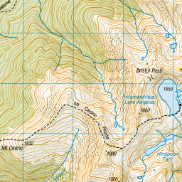
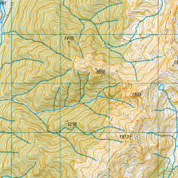
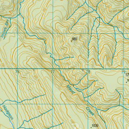
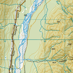
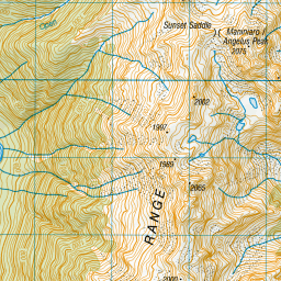
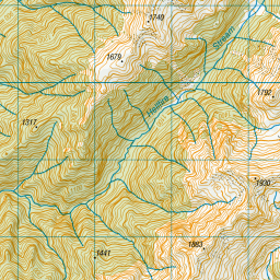

Leaflet | Sourced from LINZ. CC BY 4.0


Leaflet | Map data © OpenStreetMap contributors
[ A ] [ B ] [ C ] [ D ] [ E ] [ F ] [ G ] [ H ] [ I ] [ J ] [ K ] [ L ] [ M ] [ N ] [ O ] [ P ] [ Q ] [ R ] [ S ] [ T ] [ U ] [ V ] [ W ] [ Y ] [ Z ]
Closest 20 Huts to Coldwater Hut
These are as the crow fliesLakehead Hut 0.71km Bushline Hut 3.78km Relax Shelter 3.99km Bushedge Shelter 4.36km Speargrass Hut 5.73km Angelus Hut 6km Hopeless Hut 8.34km Sabine Hut 11.74km John Tait Hut 12.27km Cupola Hut 13.26km Mount Misery Hut 14.04km D'Urville Hut 14.67km Top Misery Hut 14.75km Lees Creek Hut 15.36km Bull Paddock Creek Hut 15.42km Connors Creek Hut 16.03km Lost Stream Bivouac 17.2km Upper Travers Hut 17.57km Begley Hut 18.26km West Sabine Hut 18.84km Beebys Hut 19.28km Mid Silverstream Hut 19.78km Bottom Misery Hut 19.78km Morgan Hut 19.83km Tiraumea Hut 19.91km Silverstream Bivouac 20.49km Branch Bivouac 20.95km Red Hills Hut 21.19km Siberia Hut 21.38km Mole Hut 22.65km Greigs Hut 24.16km Top Leatham Hut 24.72km Blue Lake Hut 24.81km George Lyon Hut 26.36km Paske Hut 27.31km Bottom Gordons Hut 27.4km Severn Hut 27.99km Porters Creek Hut 28.37km Barbers Hut 29.16km Matakitaki Base Hut 29.43km