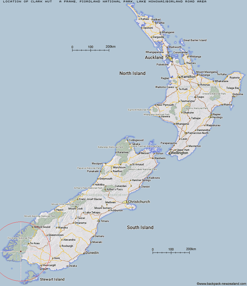
Topo Map showing location of Clark Hut - A Frame
This information is sourced from DoC, LINZ and Openstreetmap. Some of the hut photos are mine and the rest are from DoC. I will be adding an upload feature soon so people can photos of .Clark Hut - A Frame.
Basic info: basic four-bunk hut in southern Fiordland.
Latitude: -45.7923571493
Longitude: 167.331388201
Location: Fiordland National Park, Lake Monowai/Borland Road area
Area: Fiordland
Type of Hut: Basic/bivvies
Map: CE07 Topo Map | Road Map
Does this hut still exist? Have any more information? Contact
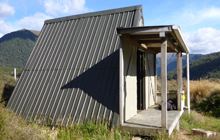
Image: DoC
Scroll down to see a topographical map and road map showing the location of Clark Hut - A Frame
[ A ] [ B ] [ C ] [ D ] [ E ] [ F ] [ G ] [ H ] [ I ] [ J ] [ K ] [ L ] [ M ] [ N ] [ O ] [ P ] [ Q ] [ R ] [ S ] [ T ] [ U ] [ V ] [ W ] [ Y ] [ Z ]
Closest 20 Huts to Clark Hut - A Frame
These are as the crow fliesHistoric Clark Hut 1.32km Monowai Hut 4.87km Green Lake Hut 5.38km Borland Bivouac 6.6km Eel Creek Hut 10.26km Rodger Inlet Huts 11.29km Hauroko Burn Hut 15.02km Halfway Hut 15.05km North Borland Hut 16.86km Caroline Hut 16.98km Lake Roe Hut 17.6km Percy Shelter 22.6km Loch Maree Hut 23.84km Kintail Hut 25.9km Upper Spey Hut 26.96km Hope Arm Hut 27.8km Back Valley Hut 28.86km West Arm Hut 30.14km Teal Bay Hut 30.62km Supper Cove Hut 31.64km Lake Poteriteri Hut 38km Redcliff Hut 39.27km Freeman Burn Hut 39.32km Cheviot Downs Hut 39.51km Shallow Bay Hut 39.78km Telford Hut 40.16km Moturau Hut 40.8km Okaka Lodge 40.81km Whare Creek Hut 40.82km Barcoo Hut 41.45km Rock Hut 43.34km Spence Hut 43.56km Upper Wairaki Hut 43.75km Iris Burn Hut 45.88km Lower Wairaki Hut 47.27km Port Craig Lodge 47.82km Port Craig School Hut 47.89km Hanging Valley Shelter 48.25km Aparima Forks Hut 48.37km Forest Burn Shelter 48.55km