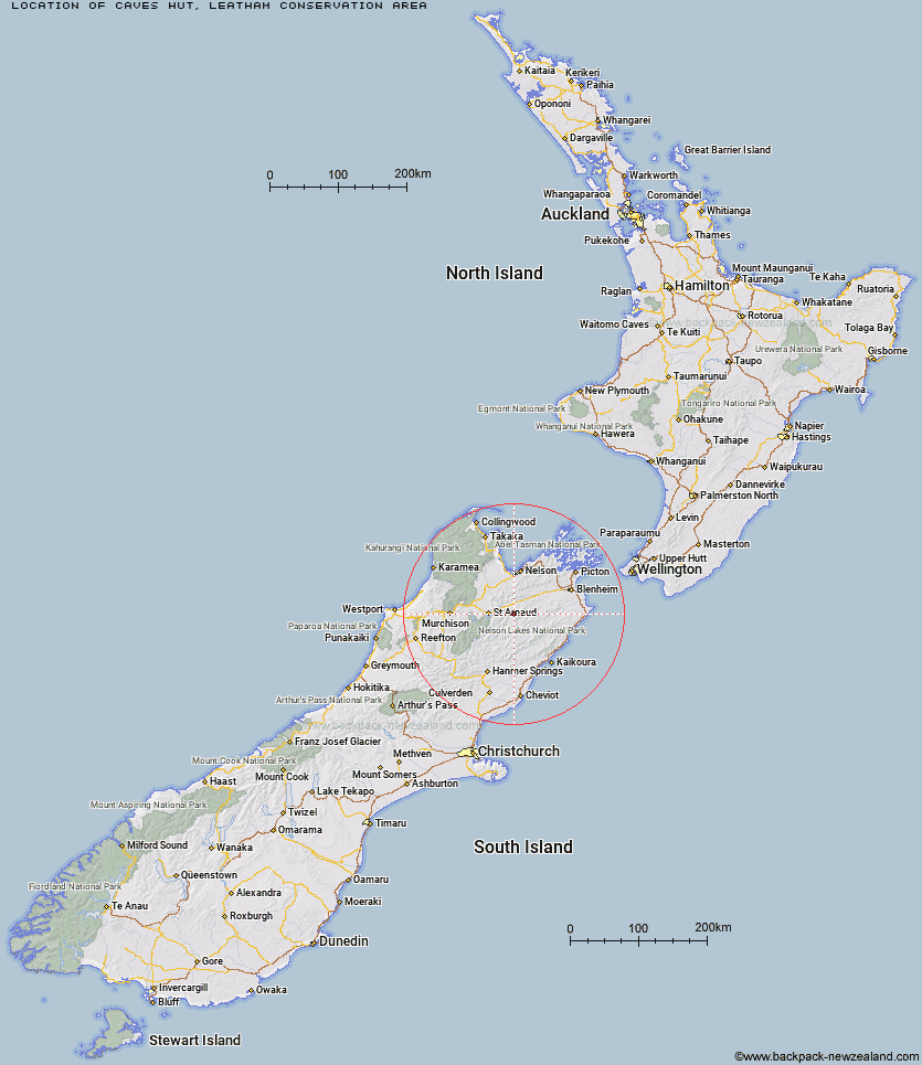
Topo Map showing location of Caves Hut
This information is sourced from DoC, LINZ and Openstreetmap. Some of the hut photos are mine and the rest are from DoC. I will be adding an upload feature soon so people can photos of .Caves Hut.
Basic info: standard 6-bunk hut in the South Marlborough area.
Latitude: -41.8064139578
Longitude: 173.190045291
Location: Leatham Conservation Area
Area: Marlborough
Type of Hut: Standard
Map: BR26 Topo Map | Road Map
Does this hut still exist? Have any more information? Contact
Basic info: standard 6-bunk hut in the South Marlborough area.
Latitude: -41.8064139578
Longitude: 173.190045291
Location: Leatham Conservation Area
Area: Marlborough
Type of Hut: Standard
Map: BR26 Topo Map | Road Map
Does this hut still exist? Have any more information? Contact
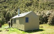
Image: DoC
Scroll down to see a topographical map and road map showing the location of Caves Hut
[ A ] [ B ] [ C ] [ D ] [ E ] [ F ] [ G ] [ H ] [ I ] [ J ] [ K ] [ L ] [ M ] [ N ] [ O ] [ P ] [ Q ] [ R ] [ S ] [ T ] [ U ] [ V ] [ W ] [ Y ] [ Z ]
Closest 20 Huts to Caves Hut
These are as the crow fliesBoulder Forks Hut 5.63km Barbers Hut 6.58km Greigs Hut 7.79km Hidden Hut 11.48km Mid Silverstream Hut 11.96km Silverstream Bivouac 12.35km Siberia Hut 12.51km Blue Mountain Hut 12.74km Turkeys Nest Bivouac 12.77km Gosling Hut 13.31km Top Gordon Hut 13.94km Bottom Gordons Hut 14.05km Lost Stream Bivouac 15.2km Bull Paddock Creek Hut 16.33km Bottom Misery Hut 16.48km Top Misery Hut 18.38km Red Hills Hut 18.47km Burnt Yards Hut 19.78km Top Whare 20.2km Top Leatham Hut 20.58km Lower Goulter Hut 21.58km Branch Bivouac 21.59km Porters Creek Hut 23.33km Lees Creek Hut 23.44km Beebys Hut 23.56km Top Wairoa Hut 23.74km Team Hut 23.91km Munroe Hut 24.14km Junction Hut 25.34km Mid Goulter Hut 25.4km Mid Wairoa Hut 26.81km Hunters Hut 27.75km Saxton Hut 27.87km Tarn Hut 28.37km Lake Chalice Hut 28.65km Carters Yards Hut 29.09km Bushline Hut 30.58km Severn Hut 31.1km Lakehead Hut 31.44km Bushedge Shelter 31.56km