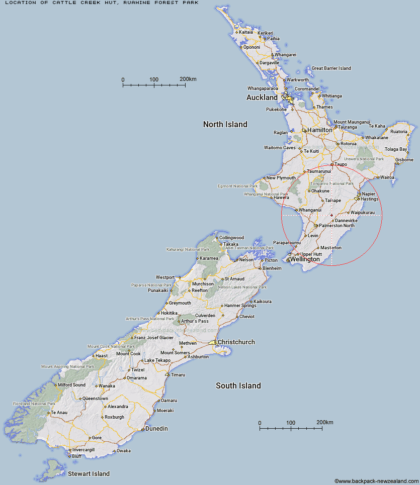
Topo Map showing location of Cattle Creek Hut
This information is sourced from DoC, LINZ and Openstreetmap. Some of the hut photos are mine and the rest are from DoC. I will be adding an upload feature soon so people can photos of .Cattle Creek Hut.
Basic info: standard eight-bunk hut in the Manawatu region.
Latitude: -40.0659487228
Longitude: 176.063679344
Location: Ruahine Forest Park
Area: Manawatu/Whanganui
Type of Hut: Standard
Tracks: Stanfield Hut Route
Map: BL36 Topo Map | Road Map
Does this hut still exist? Have any more information? Contact
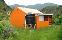
Image: DoC
Scroll down to see a topographical map and road map showing the location of Cattle Creek Hut
[ A ] [ B ] [ C ] [ D ] [ E ] [ F ] [ G ] [ H ] [ I ] [ J ] [ K ] [ L ] [ M ] [ N ] [ O ] [ P ] [ Q ] [ R ] [ S ] [ T ] [ U ] [ V ] [ W ] [ Y ] [ Z ]
Closest 20 Huts to Cattle Creek Hut
These are as the crow fliesMid Pohangina Hut 2.63km Stanfield Hut 2.78km Ngamoko Hut 3.52km Piripiri Hut 4.97km Traverse (A Frame) Hut 6.23km Leon Kinvig Hut 6.96km Makaretu Hut 8.31km Toka Bivouac 9.23km Diggers Hut 9.96km Happy Daze Hut 10.12km Top Gorge Hut 11.5km Forks Hut 11.79km Awatere Hut 12.36km Te Ekaou Hut 12.65km Alice Nash Memorial Heritage Lodge 12.97km Longview Hut 13.68km Iron Gate Hut 15.47km Triangle Hut 17.99km Daphne Hut 18.32km Kiritaki Hut 18.33km Howletts Hut 18.74km Rangiwahia Hut 19.85km Tarn Bivouac 21.41km Pourangaki Hut 23.1km Kelly Knight Hut 24.01km Hinerua Hut 24.43km Smiths Stream Hut 25.77km Waterfall Hut 26.7km Purity Hut 27.32km Waikamaka Hut 28.91km Waipawa Forks Hut 31.2km McKinnon Hut 31.72km Sunrise Hut 32.22km Triplex Hut 32.4km Crow Hut 33.3km Top Maropea Hut 33.4km Kawhatau Base 34.05km Wakelings Hut 35.07km Gold Creek Hut 35.68km Norris Hut 36.26km