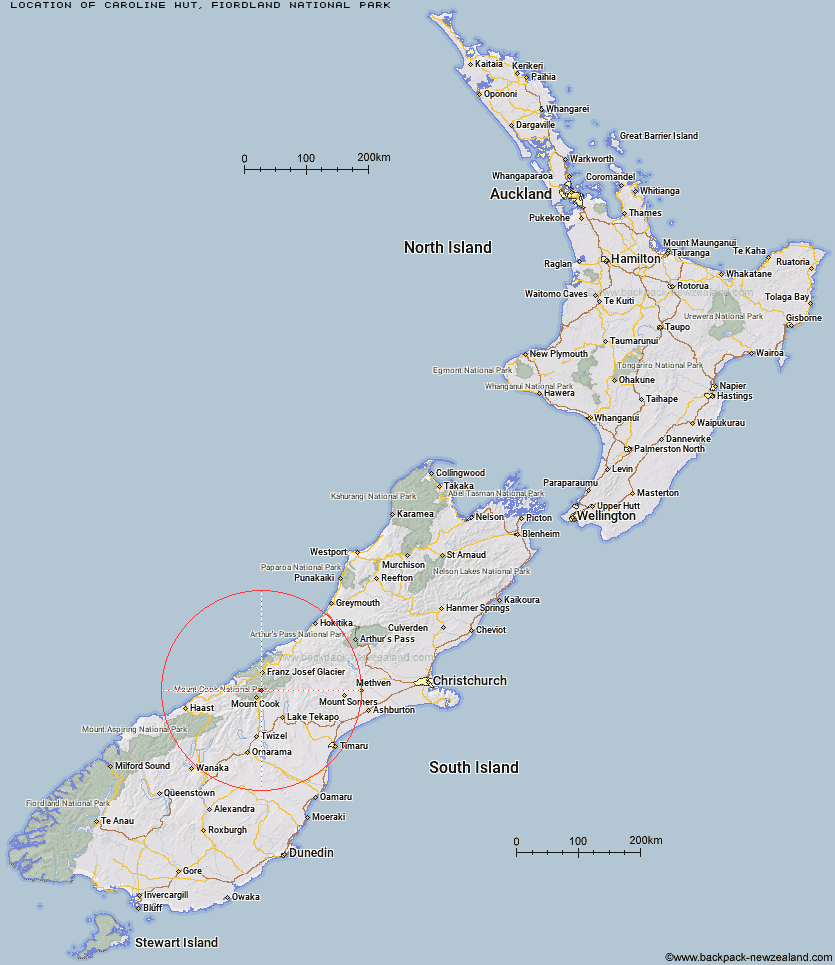
Topo Map showing location of Caroline Hut
This information is sourced from DoC, LINZ and Openstreetmap. Some of the hut photos are mine and the rest are from DoC. I will be adding an upload feature soon so people can photos of .Caroline Hut.
Basic info: basic six-bunk hut in southern Fiordland.
Latitude: -43.6357772438
Longitude: 170.170895417
Location: Fiordland National Park
Area: Fiordland
Type of Hut: Basic/bivvies
Map: CF07 Topo Map | Road Map
Does this hut still exist? Have any more information? Contact
Basic info: basic six-bunk hut in southern Fiordland.
Latitude: -43.6357772438
Longitude: 170.170895417
Location: Fiordland National Park
Area: Fiordland
Type of Hut: Basic/bivvies
Map: CF07 Topo Map | Road Map
Does this hut still exist? Have any more information? Contact
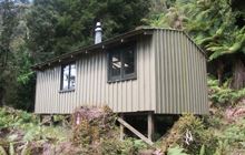
Image: DoC
Scroll down to see a topographical map and road map showing the location of Caroline Hut
[ A ] [ B ] [ C ] [ D ] [ E ] [ F ] [ G ] [ H ] [ I ] [ J ] [ K ] [ L ] [ M ] [ N ] [ O ] [ P ] [ Q ] [ R ] [ S ] [ T ] [ U ] [ V ] [ W ] [ Y ] [ Z ]
Closest 20 Huts to Caroline Hut
These are as the crow fliesBall Hut 2.02km Plateau Hut 5.89km Empress Hut 6.05km Copland Shelter 6.2km Haast Hut 6.25km Stocking Stream Shelter 9.15km Sefton Bivvy 9.6km Liebig Hut 11.27km Onslow Hut (Steffan Memorial Hut) 11.33km Pioneer Hut 11.64km Douglas Rock Hut 12.4km Mueller Hut 12.72km Littles Hut 14.14km Chancellor Hut 14.83km Centennial Hut 15.07km Harpers Rock Bivouac 17.32km Memorial Hut 17.79km Green Point Hut 18.04km Welcome Flat Campsite 18.06km Welcome Flat Hut 18.09km Almer Hut 18.19km Birdcage Hut 18.3km Tasman Saddle Hut 19.33km Barron Saddle Hut 19.38km Kelman Hut 20.06km Castle Rocks Hut 20.32km Horace Walker Hut 20.85km Tin Hut 21.55km Murchison Hut 22.23km Hende's Hut 22.56km Christmas Flat Hut 23km Architect Creek Hut 23.06km Reardon Hut 23.15km Spencer Rock Bivouac 23.53km Ryders Hut 23.99km Jollie Hut 24.25km Angus Hut 24.53km Rankin Hut 24.82km Waterfall Hut 24.88km Lame Duck Hut 25.69km