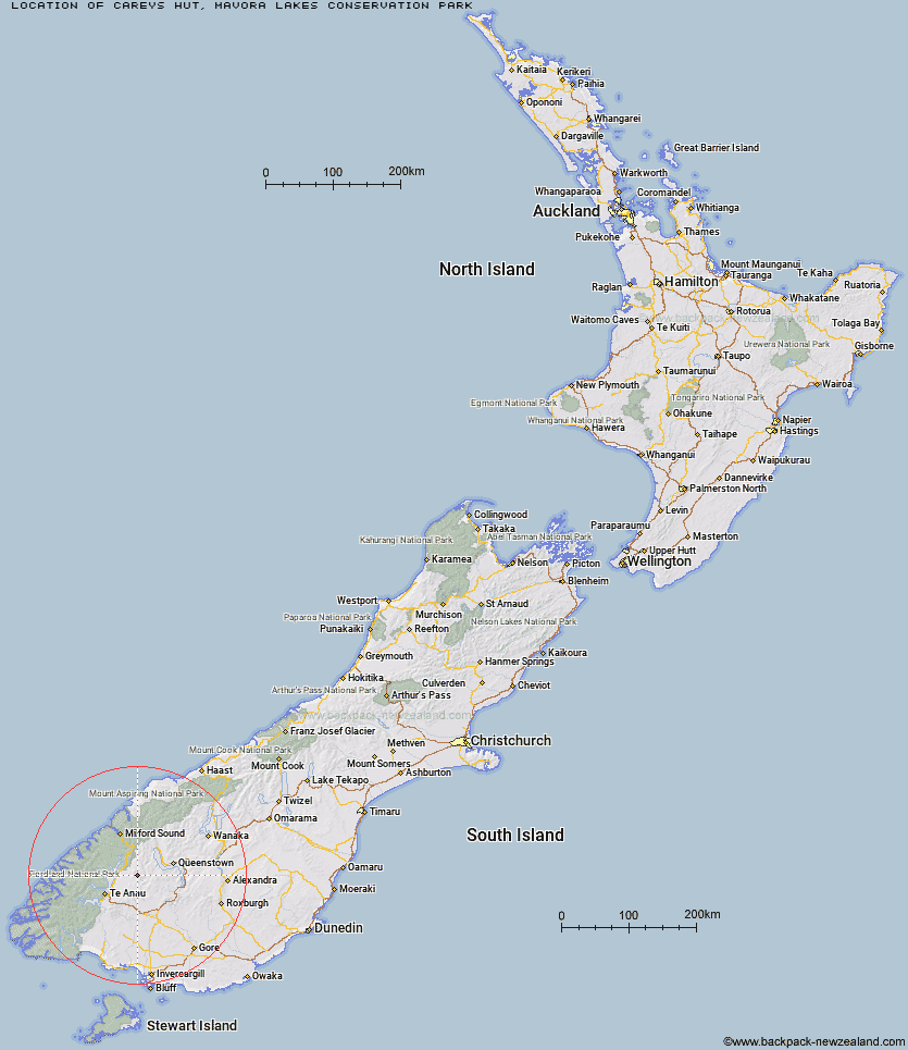
Topo Map showing location of Careys Hut
This information is sourced from DoC, LINZ and Openstreetmap. Some of the hut photos are mine and the rest are from DoC. I will be adding an upload feature soon so people can photos of .Careys Hut.
Basic info: standard six-bunk hut in the Southland area.
Latitude: -45.1882689595
Longitude: 168.164543832
Location: Mavora Lakes Conservation Park
Area: Southland
Type of Hut: Standard
Tracks: Mavora - Greenstone Walkway|Snowdon Forest tramping tracks
Map: CC10 Topo Map | Road Map
Does this hut still exist? Have any more information? Contact
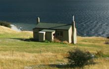
Image: DoC
Scroll down to see a topographical map and road map showing the location of Careys Hut
[ A ] [ B ] [ C ] [ D ] [ E ] [ F ] [ G ] [ H ] [ I ] [ J ] [ K ] [ L ] [ M ] [ N ] [ O ] [ P ] [ Q ] [ R ] [ S ] [ T ] [ U ] [ V ] [ W ] [ Y ] [ Z ]
Closest 20 Huts to Careys Hut
These are as the crow fliesWest Burn Hut 2.16km Boundary Hut 5.53km Forks Hut 8.77km Army Hut 13.2km Taipo Hut 15.98km Kiwi Burn Hut 19.42km Upper Oreti Hut 21.23km Lincoln Hut 22.77km Ashton Hut 23.26km Greenstone Hut 24.48km Steele Creek Lodge 25.47km Saint Marys Hut 26.44km Dog Box Bivouac 26.9km Rats Nest Hut 27.09km Slip Flat Hut 27.18km Billy Hut 27.59km Upper Windley Hut 28.52km Steele Creek Hut 29.3km Upper Cromel Hut 31.34km Cowshed Hut 31.53km Home Hill Hut 31.57km Shepherd Creek Hut 31.85km Irthing Hut 32.24km Islands Hut 32.68km Sam Summers Hut 32.76km Oreti Hut 32.76km Mid Caples Hut 34.04km Glade House 34.99km Siberia Hut 35.18km Cromel Branch Hut 35.2km McKellar Hut 35.23km McKellar Lodge 35.45km Lower Windley Hut 35.5km Ross Hut 35.99km Long Burn Hut 37.13km Clinton Hut 37.3km Worsley Hut 37.71km Upper Caples Hut 38.55km Mitchells Hut 39.27km Mansion Hut 40.15km