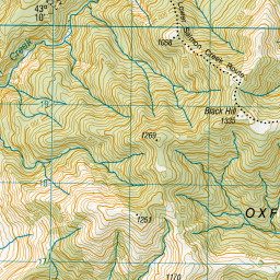
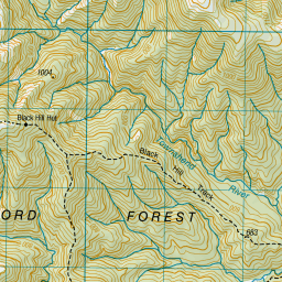
Topo Map showing location of Black Hill Hut
This information is sourced from DoC, LINZ and Openstreetmap. Some of the hut photos are mine and the rest are from DoC. I will be adding an upload feature soon so people can photos of .Black Hill Hut.
Basic info: standard six-bunk hut in the North Canterbury and Arthur's Pass area.
Latitude: -43.179308608
Longitude: 172.006183303
Location: Oxford Forest Conservation Area
Area: Canterbury
Type of Hut: Standard
Tracks: Black Hill Hut tracks
Map: BW22 Topo Map | Road Map
Does this hut still exist? Have any more information? Contact
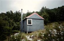
Image: DoC
Scroll down to see a topographical map and road map showing the location of Black Hill Hut
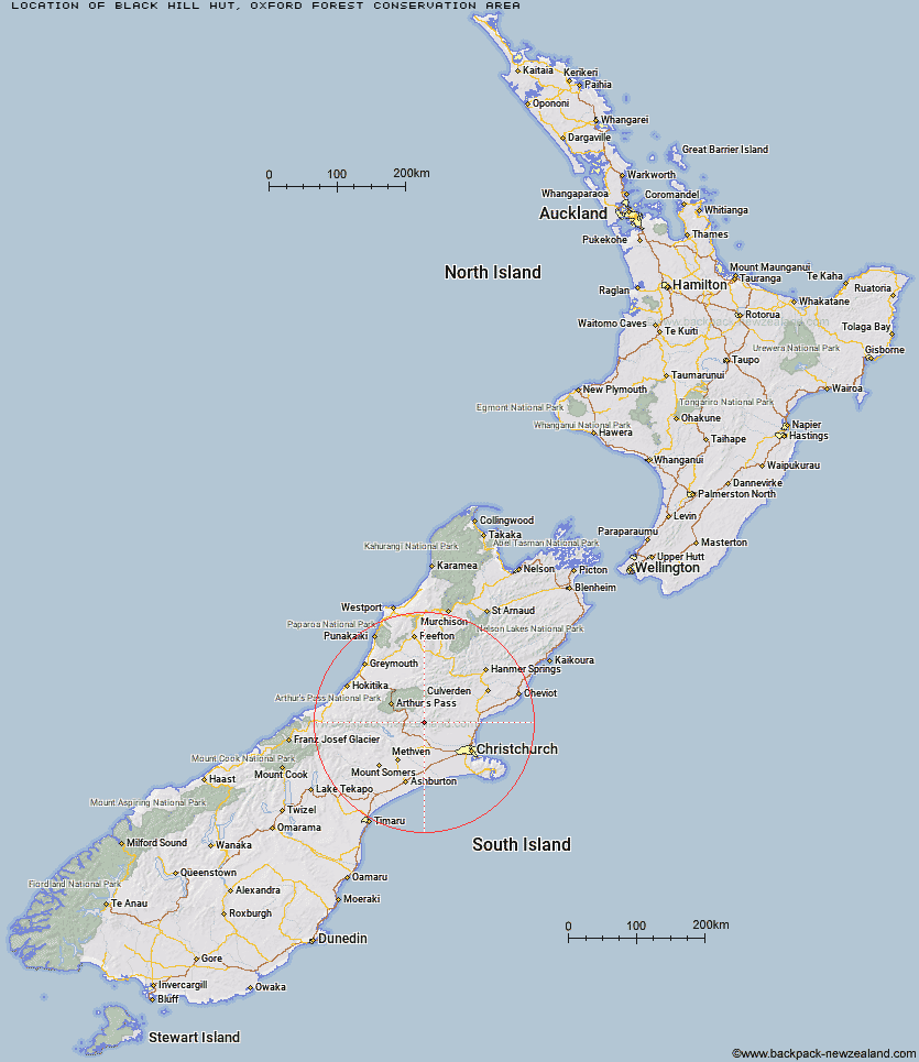
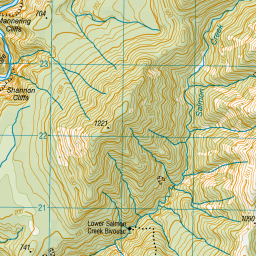
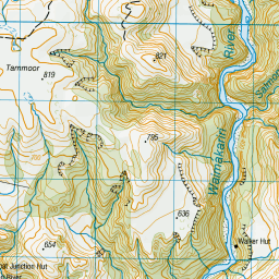
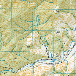
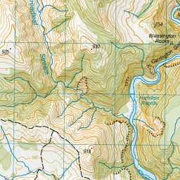
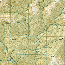
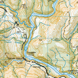
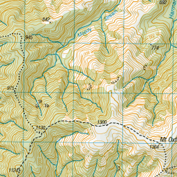
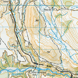
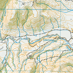
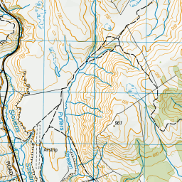
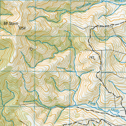
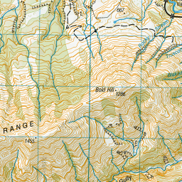
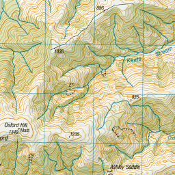

Leaflet | Sourced from LINZ. CC BY 4.0


Leaflet | Map data © OpenStreetMap contributors
[ A ] [ B ] [ C ] [ D ] [ E ] [ F ] [ G ] [ H ] [ I ] [ J ] [ K ] [ L ] [ M ] [ N ] [ O ] [ P ] [ Q ] [ R ] [ S ] [ T ] [ U ] [ V ] [ W ] [ Y ] [ Z ]
Closest 20 Huts to Black Hill Hut
These are as the crow fliesLower Salmon Creek Bivouac 2.86km Wharfedale Hut 3.45km Walker Hut 4.72km Kinnebrooks Hut 6.68km Hamilton Hut 7.49km Puketeraki Bivouac 7.94km Petticoat Junction Hut 7.96km Rosa Hut 8.69km Adams Hut 13.45km Broken River Hut 13.83km Lilburne Hut 16.18km Tarn Hut 19.46km Youngman Stream Hut 22.34km Bob's Camp Bivouac 23.51km Turnbull Bivouac 26.06km Andrews Shelter 26.91km Cass Saddle Hut 27.08km Riversdale Hut 27.15km Lochinvar Hut 27.23km Pinchgut Hut 27.44km Anna Hut 28.18km Benmore Hut 29.22km Hawdon Shelter 29.94km Hamilton Hut 31.02km Cattle Creek Hut 31.07km Bull Creek Hut 31.97km Ant Stream Hut 32.11km Anderson's Hut 33.22km Bealey Hut 33.52km West Harper Hut 33.57km Sudden Valley Bivouac 35.39km Ant Stream Bivouac 35.45km Lagoon Saddle A Frame Hut 35.61km Lagoon Saddle Hut 35.68km Esk Bivouac 36.13km East Hawdon Bivouac 36.25km Ranger Bivouac 37.08km Hawdon Hut 37.19km Seldom Inn Hut 38.31km Trust/Poulter Hut 38.46km