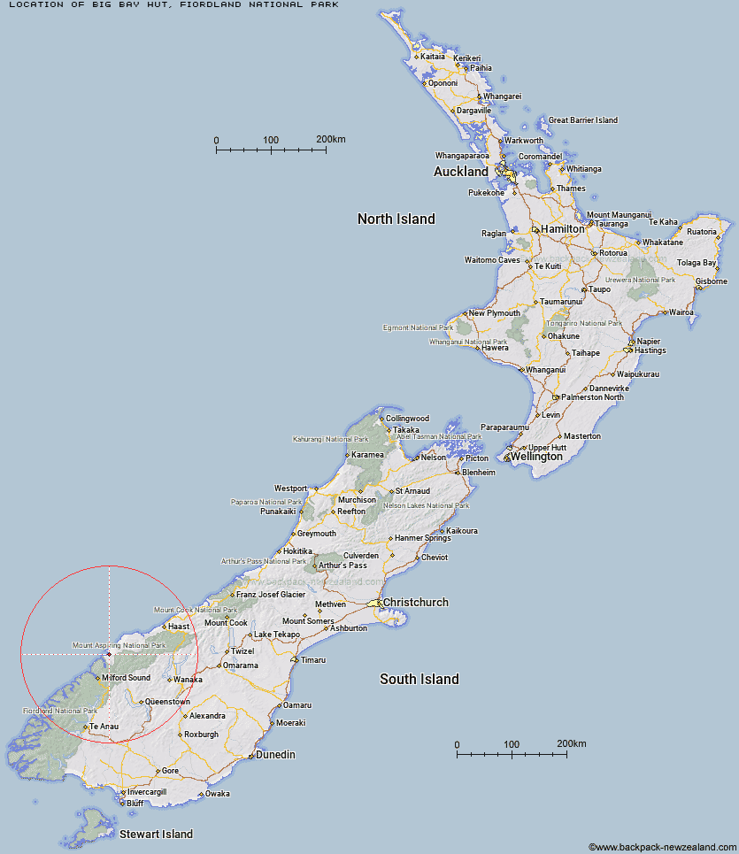
Topo Map showing location of Big Bay Hut
This information is sourced from DoC, LINZ and Openstreetmap. Some of the hut photos are mine and the rest are from DoC. I will be adding an upload feature soon so people can photos of .Big Bay Hut.
Basic info: standard nine-bunk hut in northern Fiordland.
Latitude: -44.2989862313
Longitude: 168.11539177
Location: Fiordland National Park
Area: Fiordland
Type of Hut: Standard
Tracks: Pyke - Big Bay Route
Map: BZ09 Topo Map | Road Map
Does this hut still exist? Have any more information? Contact
Basic info: standard nine-bunk hut in northern Fiordland.
Latitude: -44.2989862313
Longitude: 168.11539177
Location: Fiordland National Park
Area: Fiordland
Type of Hut: Standard
Tracks: Pyke - Big Bay Route
Map: BZ09 Topo Map | Road Map
Does this hut still exist? Have any more information? Contact
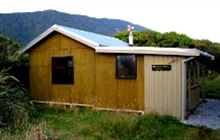
Image: DoC
Scroll down to see a topographical map and road map showing the location of Big Bay Hut
[ A ] [ B ] [ C ] [ D ] [ E ] [ F ] [ G ] [ H ] [ I ] [ J ] [ K ] [ L ] [ M ] [ N ] [ O ] [ P ] [ Q ] [ R ] [ S ] [ T ] [ U ] [ V ] [ W ] [ Y ] [ Z ]
Closest 20 Huts to Big Bay Hut
These are as the crow fliesMartins Bay Hut 9.84km Gorge River Hut 14.22km Hokuri Hut 14.36km Olivine Hut 17.89km Spoon Hut 21.53km Demon Trail Hut 21.96km McKerrow Island Hut 24.69km Kaipo Hut 25.11km Lake Alabaster Hut 27.55km Pawnbroker Rock 33.94km Daleys Flat Hut 34.51km Hidden Falls Hut 36.09km Turners Bivouac 36.51km Sunshine Hut 36.73km Arawhata Rock Bivouac 41.19km Esquilant Bivvy Hut 42.11km Shelter Rock Hut 42.55km Dart Hut 42.77km Earnslaw Hut 44.53km Sandfly Point Shelter 46.08km Liverpool Hut 46.12km Colin Todd Hut 46.78km Scotts Rock Bivouac 46.86km Twenty Five Mile Hut 47.29km Aspiring Hut 47.61km Routeburn Falls Hut 47.93km Routeburn Falls Lodge 47.97km Stafford Hut 48.05km Routeburn Flats Hut 48.1km French Ridge Hut 48.2km Routeburn Shelter 48.45km Gill's Bivvy 48.88km Cascade Hut 48.93km Phil's Bivvy 49.62km Giant Gate Shelter 49.92km Lochnagar Hut 51.88km Lake Mackenzie Hut 52.3km Lake Mackenzie Lodge 52.44km Homer Hut 52.84km Tummel Burn Hut 53.25km