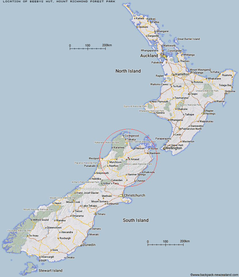
Topo Map showing location of Beebys Hut
This information is sourced from DoC, LINZ and Openstreetmap. Some of the hut photos are mine and the rest are from DoC. I will be adding an upload feature soon so people can photos of .Beebys Hut.
Basic info: standard 6-bunk hut in the Nelson Lakes area.
Latitude: -41.7192791771
Longitude: 172.931122177
Location: Mount Richmond Forest Park
Area: Nelson/Tasman
Type of Hut: Standard
Map: BR25 Topo Map | Road Map
Does this hut still exist? Have any more information? Contact
Basic info: standard 6-bunk hut in the Nelson Lakes area.
Latitude: -41.7192791771
Longitude: 172.931122177
Location: Mount Richmond Forest Park
Area: Nelson/Tasman
Type of Hut: Standard
Map: BR25 Topo Map | Road Map
Does this hut still exist? Have any more information? Contact
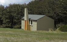
Image: DoC
Scroll down to see a topographical map and road map showing the location of Beebys Hut
[ A ] [ B ] [ C ] [ D ] [ E ] [ F ] [ G ] [ H ] [ I ] [ J ] [ K ] [ L ] [ M ] [ N ] [ O ] [ P ] [ Q ] [ R ] [ S ] [ T ] [ U ] [ V ] [ W ] [ Y ] [ Z ]
Closest 20 Huts to Beebys Hut
These are as the crow fliesRed Hills Hut 5.19km Porters Creek Hut 9.14km Silverstream Bivouac 12.39km Bull Paddock Creek Hut 13.7km Hunters Hut 14.59km Mid Silverstream Hut 15.24km Bushline Hut 15.83km Bushedge Shelter 15.98km Relax Shelter 16.37km Top Wairoa Hut 17km Lost Stream Bivouac 18.02km Top Misery Hut 19.06km Coldwater Hut 19.28km Greigs Hut 19.46km Lakehead Hut 19.6km Speargrass Hut 20.92km Siberia Hut 21.42km Mid Wairoa Hut 22.86km Bottom Misery Hut 23.51km Lower Goulter Hut 23.55km Caves Hut 23.56km Angelus Hut 24.13km Lees Creek Hut 25.17km Barbers Hut 25.42km Tarn Hut 27.1km Hopeless Hut 27.58km Boulder Forks Hut 27.94km Branch Bivouac 28.55km Bottom Gordons Hut 28.83km Sabine Hut 28.94km Mid Goulter Hut 29.62km Hidden Hut 30.35km Top Leatham Hut 30.88km D'Urville Hut 31.41km John Tait Hut 31.44km Connors Creek Hut 32.04km Mount Misery Hut 32.2km Top Gordon Hut 32.2km Cupola Hut 32.54km Turkeys Nest Bivouac 32.57km