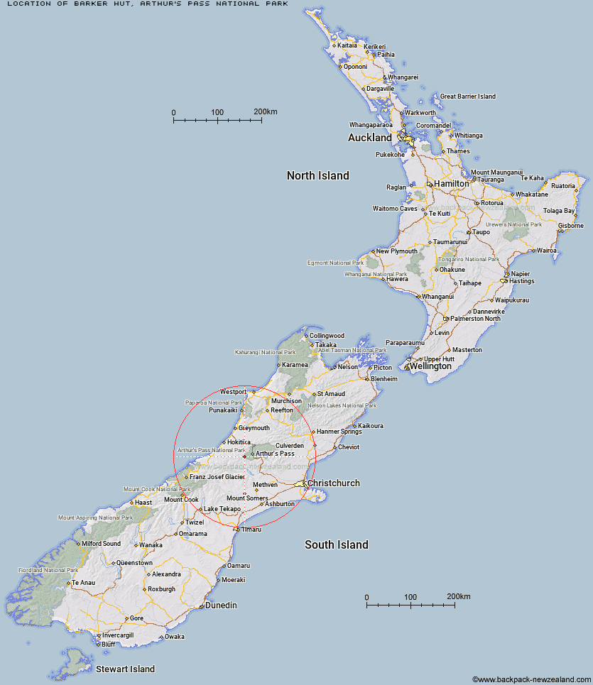
Topo Map showing location of Barker Hut
This information is sourced from DoC, LINZ and Openstreetmap. Some of the hut photos are mine and the rest are from DoC. I will be adding an upload feature soon so people can photos of .Barker Hut.
Basic info: standard 10-bunk hut in the North Canterbury and Arthur's Pass area.
Latitude: -42.9889497863
Longitude: 171.397644989
Location: Arthur's Pass National Park
Area: Canterbury
Type of Hut: Serviced Alpine
Tracks: Carrington Hut Route
Map: BV20 Topo Map | Road Map
Does this hut still exist? Have any more information? Contact
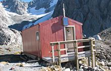
Image: DoC
Scroll down to see a topographical map and road map showing the location of Barker Hut
[ A ] [ B ] [ C ] [ D ] [ E ] [ F ] [ G ] [ H ] [ I ] [ J ] [ K ] [ L ] [ M ] [ N ] [ O ] [ P ] [ Q ] [ R ] [ S ] [ T ] [ U ] [ V ] [ W ] [ Y ] [ Z ]
Closest 20 Huts to Barker Hut
These are as the crow fliesPark Morpeth Hut 4.92km Carrington Hut 5.24km Avoca Hut 7.62km Urquhart's Hut 8.25km Weka Burnet Bivouac 8.62km Anti Crow Hut 9.33km Harman Hut 9.89km Old Julia Hut 10.37km Julia Hut 10.39km Campbell Bivouac 10.62km Waimakariri Falls Hut 10.8km Crow Hut 10.95km Back Basin Hide 11.29km Top Crawford Hut 11.36km Mudflats Hut 12.93km Unknown Stream Hut 13.22km Browning Range Bivouac 13.64km Crawford Junction Hut 13.65km Grassy Flat Hut 13.77km Old Basins Hut 14.04km Basins Hut 14.14km Moa Hut 14.66km Bealey Spur Hut 14.84km Jacks Hut 15.22km Fanghill Hut 15.59km Klondyke Shelter 15.65km Greyneys Shelter 15.67km Mid Taipo Hut 15.88km Newton Range Bivouac 15.93km Mid Styx Hut 16.19km Newton Creek Hut 16.5km Lower Arahura Hut 16.75km Mungo Hut 16.8km Top Kokatahi Hut 16.99km Dunns Creek Hut 17.33km Boo Boo Hut 17.56km Lagoon Saddle Hut 18.08km Lagoon Saddle A Frame Hut 18.15km Lower Olderog Bivouac 18.36km Hunts Creek Hut 18.53km