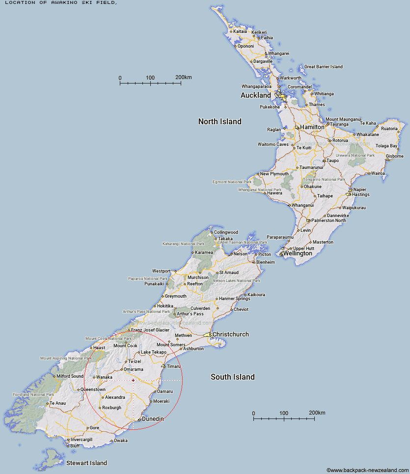
Topo Map showing location of Awakino Ski Field
This information is sourced from DoC, LINZ and Openstreetmap. Some of the hut photos are mine and the rest are from DoC. I will be adding an upload feature soon so people can photos of .Awakino Ski Field.
Latitude: -44.7779252433
Longitude: 170.308809133
Location:
Type of Hut:
Map: Topo Map | Road Map
Does this hut still exist? Have any more information? Contact
Latitude: -44.7779252433
Longitude: 170.308809133
Location:
Type of Hut:
Map: Topo Map | Road Map
Does this hut still exist? Have any more information? Contact
Scroll down to see a topographical map and road map showing the location of Awakino Ski Field
[ A ] [ B ] [ C ] [ D ] [ E ] [ F ] [ G ] [ H ] [ I ] [ J ] [ K ] [ L ] [ M ] [ N ] [ O ] [ P ] [ Q ] [ R ] [ S ] [ T ] [ U ] [ V ] [ W ] [ Y ] [ Z ]
Closest 20 Huts to Awakino Ski Field
These are as the crow fliesHut Creek Hut 6.58km Tailings Hut 10.17km Chimney Creek Hut 10.32km Brown Hut 12.77km Ida Railway Hut 14.24km Buster Hut 16.41km Wire Yards Hut 17.1km Pearson Hut 21.66km Otamatapaio Hut 27.79km Balmoral Huts 32.52km Boundary Creek Hut 36.26km Crumb Hut 37.4km Middle Hut 37.58km Top Hut 41.18km Half Moon Hut 43.03km Mitchells Hut 46.3km Grays Hut 47.19km Mount Hut 47.89km Richmond Hut 49.59km Cayenne Hut 50.06km Lauder Basin Hut 51.73km Gentle Annie Hut 52.11km Bog Hut 54.62km Polson's Hut 56.38km Red Hut 59.7km Staircase Hut 64.31km Burnt Bush Hut 67.47km Waitaki Huts 68.06km Hideaway Hut 69.15km Top Timaru Hut 72.47km Snowy Gorge Hut 73.32km Leaning Lodge 73.41km Stodys Hut 73.79km Big Hut 75.41km Mae West Bivouac 75.77km Maitland Hut 76.88km Baikie Hut 76.97km Cotters Hut 77.89km Pakituhi Hut 78.39km Moonlight & Roses Hut 78.53km