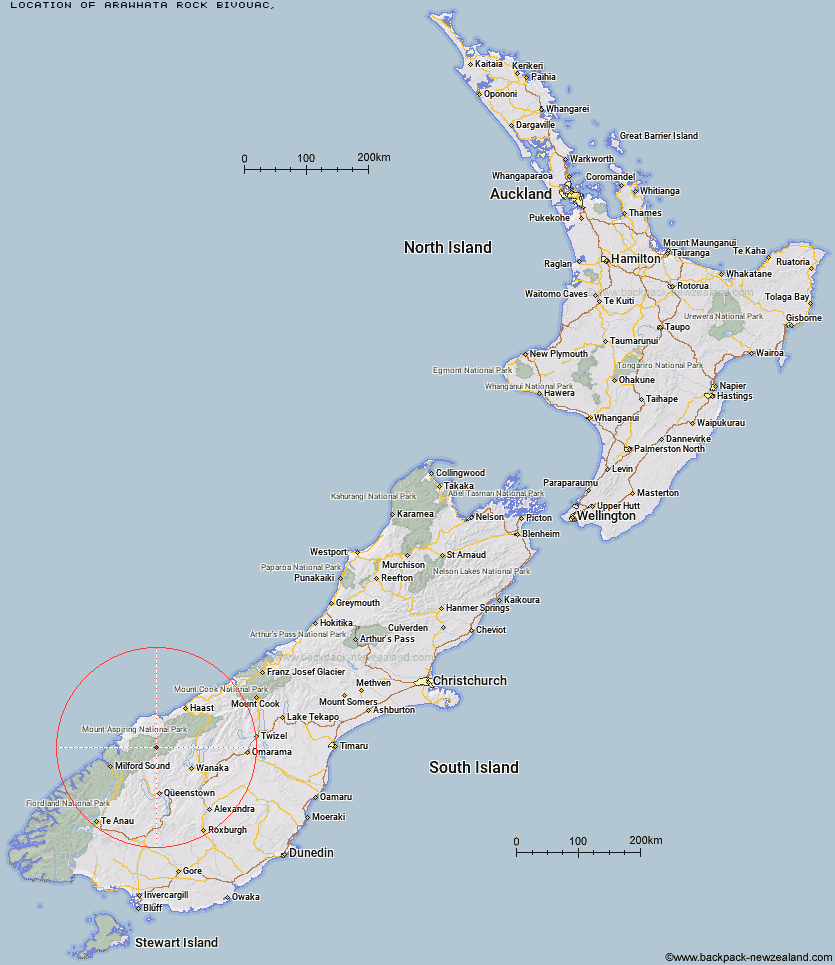
Topo Map showing location of Arawhata Rock Bivouac
This information is sourced from DoC, LINZ and Openstreetmap. Some of the hut photos are mine and the rest are from DoC. I will be adding an upload feature soon so people can photos of .Arawhata Rock Bivouac.
Latitude: -44.4136212696
Longitude: 168.608068148
Location:
Type of Hut:
Map: Topo Map | Road Map
Does this hut still exist? Have any more information? Contact
Latitude: -44.4136212696
Longitude: 168.608068148
Location:
Type of Hut:
Map: Topo Map | Road Map
Does this hut still exist? Have any more information? Contact
Scroll down to see a topographical map and road map showing the location of Arawhata Rock Bivouac
[ A ] [ B ] [ C ] [ D ] [ E ] [ F ] [ G ] [ H ] [ I ] [ J ] [ K ] [ L ] [ M ] [ N ] [ O ] [ P ] [ Q ] [ R ] [ S ] [ T ] [ U ] [ V ] [ W ] [ Y ] [ Z ]
Closest 20 Huts to Arawhata Rock Bivouac
These are as the crow fliesLiverpool Hut 4.95km Scotts Rock Bivouac 5.77km French Ridge Hut 7.02km Aspiring Hut 8.18km Colin Todd Hut 8.28km Cascade Hut 10.02km Dart Hut 12.74km Rock of Ages Bivouac 14.83km Raspberry Creek Shelter 15.64km Tummel Burn Hut 17.91km Shelter Rock Hut 17.95km Lochnagar Hut 20.27km Hundred Mile Hut 22km Daleys Flat Hut 23.82km Earnslaw Hut 26.41km Black Peak Hut 26.88km Top Forks Hut 27.33km Twenty Five Mile Hut 27.5km Esquilant Bivvy Hut 27.52km Sixteen Mile Huts 28.99km Polnoon Hut 30.25km Shiel Burn Hut 31.4km Olivine Hut 31.48km Saddle Hut 32.98km Cabin Hut 34.16km Albert Burn Hut 34.86km Spoon Hut 36.32km Ballarat Hut - Flood Burn 37.71km Kerin Forks Hut 39.18km Lake Alabaster Hut 39.64km Big Bay Hut 41.19km Gorge River Hut 41.69km Bullendale Hut 41.9km Archie's Hut - Copper Creek 42.59km Routeburn Shelter 42.84km Siberia Hut 42.92km Dynamo Hut 43.32km Demon Trail Hut 43.38km Hokuri Hut 43.81km Wanaka Faces Hut 44.62km