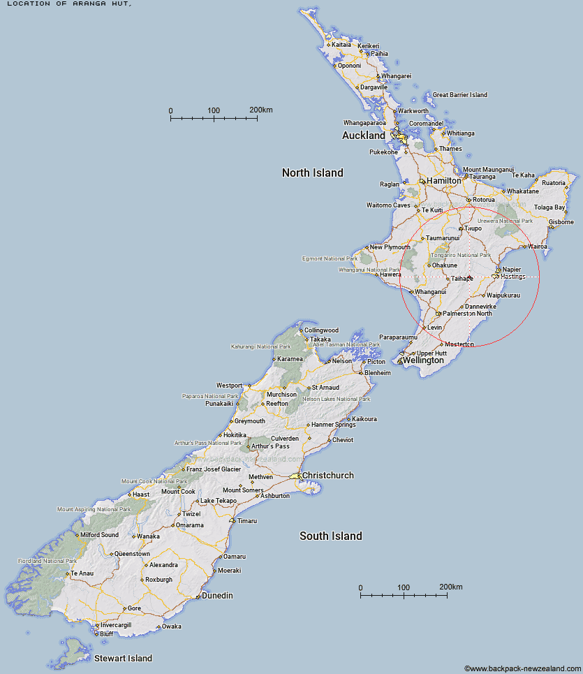
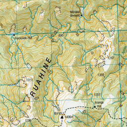
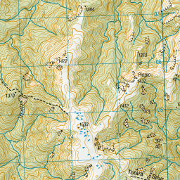
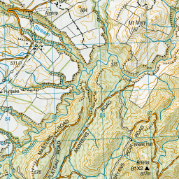
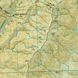
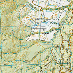
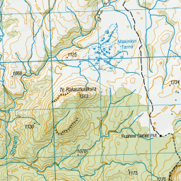
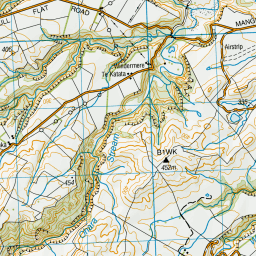
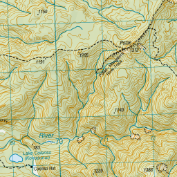
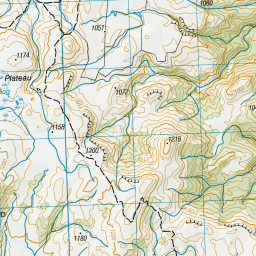
Topo Map showing location of Aranga Hut
This information is sourced from DoC, LINZ and Openstreetmap. Some of the hut photos are mine and the rest are from DoC. I will be adding an upload feature soon so people can photos of .Aranga Hut.
Latitude: -39.6343374503
Longitude: 176.253544688
Location:
Type of Hut:
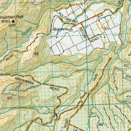
Map: Topo Map | Road Map
Does this hut still exist? Have any more information? Contact
Latitude: -39.6343374503
Longitude: 176.253544688
Location:
Type of Hut:
Map: Topo Map | Road Map
Does this hut still exist? Have any more information? Contact
Scroll down to see a topographical map and road map showing the location of Aranga Hut

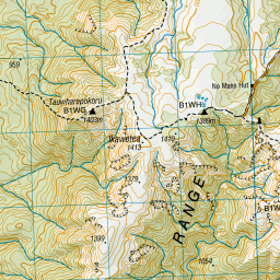
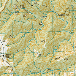
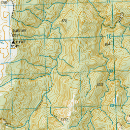
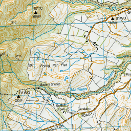
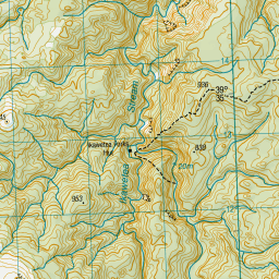
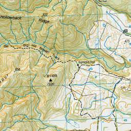
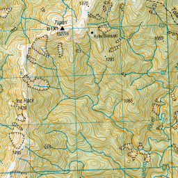
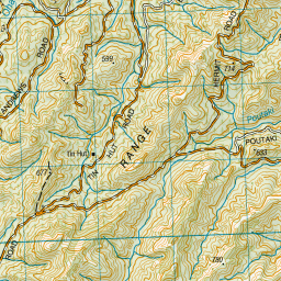

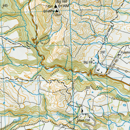

Leaflet | Sourced from LINZ. CC BY 4.0


Leaflet | Map data © OpenStreetMap contributors
[ A ] [ B ] [ C ] [ D ] [ E ] [ F ] [ G ] [ H ] [ I ] [ J ] [ K ] [ L ] [ M ] [ N ] [ O ] [ P ] [ Q ] [ R ] [ S ] [ T ] [ U ] [ V ] [ W ] [ Y ] [ Z ]
Closest 20 Huts to Aranga Hut
These are as the crow fliesMistake Bivouac 2.75km Rockslide Hut 3.21km Sentry Box Hut 4.49km Parks Peak Hut 4.81km Upper Makaroro Hut 5.53km No Mans Hut 5.81km Masters Shelter 5.85km Kylie Bivouac 6.85km Ikawetea Forks Hut 6.87km Ruahine Corner Hut 7km Dead Dog Hut 7.31km Briens Hut 8.27km Herricks Hut 8.61km Tin Hut 8.76km Ellis Hut 9.17km Makirikiri Hut 9.44km Barlow Hut 9.59km Taruarau Bivouac 10.4km Colenso Hut 10.51km Dianes Hut 10.55km Ruahine Hut 10.55km Poutaki Hut 11.64km Sparrowhawk Bivouac 13.17km Shutes Hut 14.03km Maropea Forks Hut 14.48km Iron Bark Hut 14.75km Gold Creek Hut 14.97km Norris Hut 15.01km Otukota Hut 16.27km Wakelings Hut 17.06km Cedars Hut (Blowfly) 17.52km Top Maropea Hut 17.59km Triplex Hut 18.31km Sunrise Hut 18.53km Comet Hut 18.71km Waipawa Forks Hut 19.47km Crow Hut 20.62km McKinnon Hut 21.28km Waikamaka Hut 22.21km Kawhatau Base 22.83km