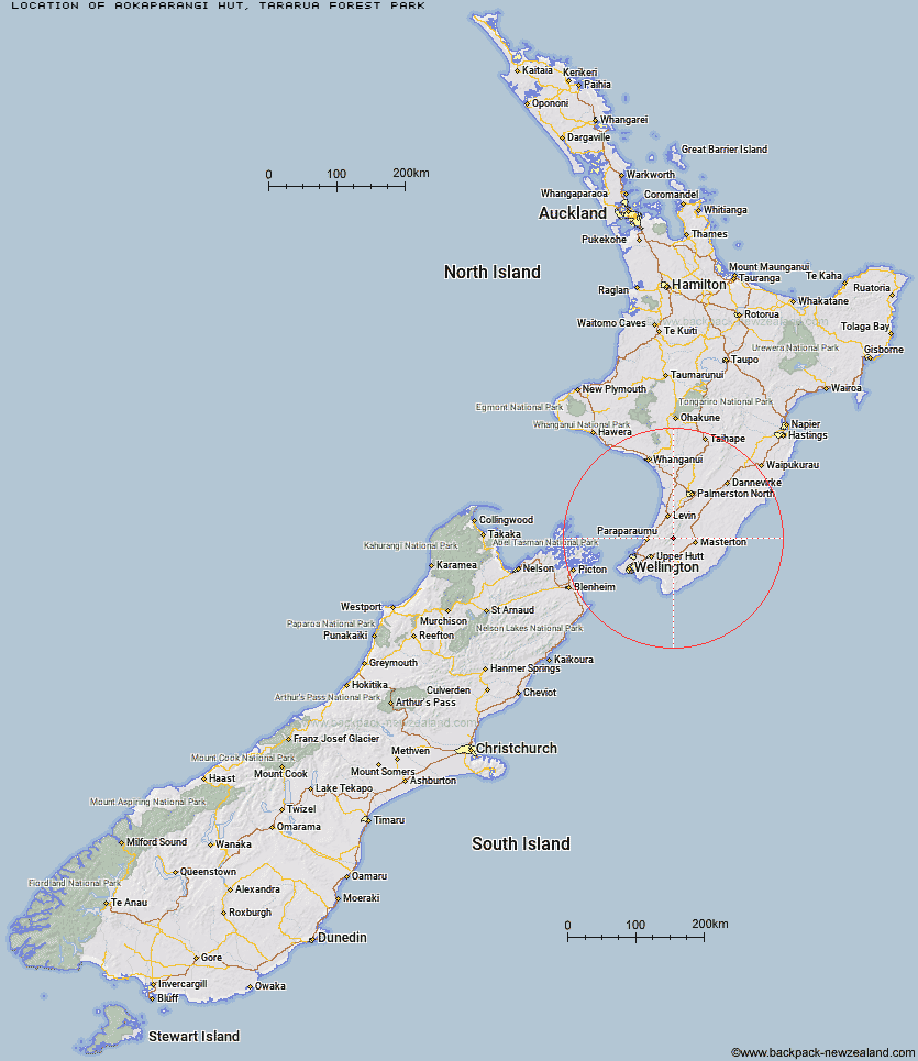
Topo Map showing location of Aokaparangi Hut
This information is sourced from DoC, LINZ and Openstreetmap. Some of the hut photos are mine and the rest are from DoC. I will be adding an upload feature soon so people can photos of .Aokaparangi Hut.
Basic info: basic two-bunk hut in the Kapiti region.
Latitude: -40.8918543556
Longitude: 175.360343312
Location: Tararua Forest Park
Area: Wellington/Kapiti
Type of Hut: Basic/bivvies
Map: BP33 Topo Map | Road Map
Does this hut still exist? Have any more information? Contact
Basic info: basic two-bunk hut in the Kapiti region.
Latitude: -40.8918543556
Longitude: 175.360343312
Location: Tararua Forest Park
Area: Wellington/Kapiti
Type of Hut: Basic/bivvies
Map: BP33 Topo Map | Road Map
Does this hut still exist? Have any more information? Contact
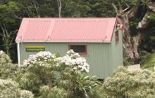
Image: DoC
Scroll down to see a topographical map and road map showing the location of Aokaparangi Hut
[ A ] [ B ] [ C ] [ D ] [ E ] [ F ] [ G ] [ H ] [ I ] [ J ] [ K ] [ L ] [ M ] [ N ] [ O ] [ P ] [ Q ] [ R ] [ S ] [ T ] [ U ] [ V ] [ W ] [ Y ] [ Z ]
Closest 20 Huts to Aokaparangi Hut
These are as the crow fliesMid Waiohine Hut 2.67km Maungahuka Hut 3.17km Neill Forks Hut 4.56km Anderson Memorial Hut 5.06km Powell Hut 5.42km Totara Flats Hut 5.79km Mountain House Shelter 6km Penn Creek Hut 6.31km Sayer Hut 6.71km McGregor Bivouac 7.83km Jumbo Hut 7.88km Waitewaewae Hut 8.16km Atiwhakatu Hut 8.31km Field Hut 8.93km Nichols Hut 9.17km Kime Hut 9.36km Mid King Bivouac 10.3km Cone Hut 10.69km Dorset Ridge Hut 10.73km Carkeek Hut 11.7km Mitre Flats Hut 12.07km Alpha Hut 12.35km Tarn Ridge Hut 12.91km Waiohine Shelter 13.13km Tutuwai Hut 13.48km Dracophyllum Hut 13.81km Elder Hut 13.95km Waiotauru Hut 15.62km Eastern Hutt Hut 16.12km Arete Forks Hut 16.2km Cow Creek Hut 16.87km Arete Hut 17.19km Blue Range Hut 17.25km Kapakapanui Hut 17.44km Te Matawai Hut 17.46km Renata Hut 17.92km Waiopehu Hut 18.41km Smith Creek Shelter 19.33km South Ohau Hut 19.49km Waikawa Shelter 21.27km