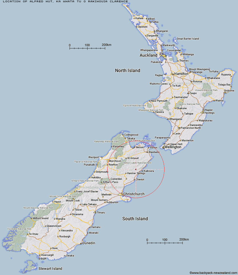
Topo Map showing location of Alfred Hut
This information is sourced from DoC, LINZ and Openstreetmap. Some of the hut photos are mine and the rest are from DoC. I will be adding an upload feature soon so people can photos of .Alfred Hut.
Basic info: standard 4-bunk hut in the South Marlborough area.
Latitude: -42.3249706883
Longitude: 173.348650237
Location: Ka Whata Tu o Rakihouia Clarence
Area: Marlborough
Type of Hut: Standard
Map: BT26 Topo Map | Road Map
Does this hut still exist? Have any more information? Contact
Basic info: standard 4-bunk hut in the South Marlborough area.
Latitude: -42.3249706883
Longitude: 173.348650237
Location: Ka Whata Tu o Rakihouia Clarence
Area: Marlborough
Type of Hut: Standard
Map: BT26 Topo Map | Road Map
Does this hut still exist? Have any more information? Contact
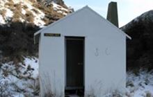
Image: DoC
Scroll down to see a topographical map and road map showing the location of Alfred Hut
[ A ] [ B ] [ C ] [ D ] [ E ] [ F ] [ G ] [ H ] [ I ] [ J ] [ K ] [ L ] [ M ] [ N ] [ O ] [ P ] [ Q ] [ R ] [ S ] [ T ] [ U ] [ V ] [ W ] [ Y ] [ Z ]
Closest 20 Huts to Alfred Hut
These are as the crow fliesKahutara Bivouac 4.78km Palmer Bivouac 7.68km Palmer Hut 8.2km Black Spur Historic Hut 8.39km Tent Poles Hut 8.55km Warden Hut 9.01km Stone Jug Hut 10.06km Seymour Hut 12.17km Lake McRae Hut 15.55km Cloudy Hut 15.99km Limestone Hut 16.3km Half Moon Hut 18km Mt Fyffe Hut 20.12km Kowhai Hut 20.48km Dubious Bivouac 21.31km Guide Hut 23.72km Goose Flat Hut 25.51km Hapuku Hut 25.58km Barratts Hut 28.05km Barratts Bivouac 28.1km Fidgit Bivouac 28.42km Yarra Hut 29.22km Acheron Hut 29.79km Carters Yards Hut 31.33km Red Gate Hut 32.43km Saxton Hut 34.05km Junction Hut 34.47km Munroe Hut 34.99km Haycocks Bivouac 36.71km Ravine Hut 36.83km Team Hut 36.92km Severn Hut 38.93km Jam Hut 39.52km Burnt Yards Hut 40.29km Old Middlehurst Hut 42.27km Sedgemere Sleepout 42.54km Hornby Bivvy 43.58km Snowgrass Hut 44.24km Top Leatham Hut 44.87km Top Gordon Hut 45.52km