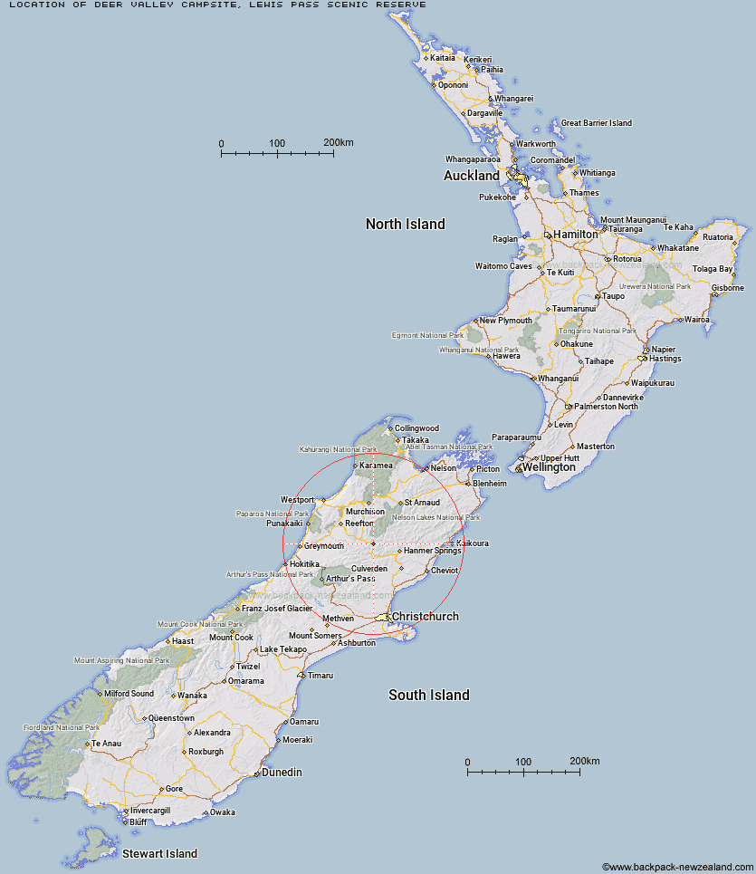
Map showing location of Deer Valley Campsite
Latitude: -42.40483627
Longitude: 172.39770877
Location: Lewis Pass Scenic Reserve, Canterbury
Cost: 18+ $8 :: 17 and under $4 :: 0 - 4 free
Access: Car,Campervan,Caravan
Facilities: Water from stream,Wheelchair accessible with assistance
DoC Page: Deer Valley Campsite
Longitude: 172.39770877
Location: Lewis Pass Scenic Reserve, Canterbury
Cost: 18+ $8 :: 17 and under $4 :: 0 - 4 free
Access: Car,Campervan,Caravan
Facilities: Water from stream,Wheelchair accessible with assistance
DoC Page: Deer Valley Campsite
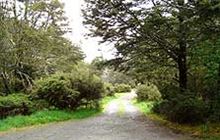
Image: DoC
Scroll down to see a more detailed map showing the location of Deer Valley Campsite


Leaflet | Map data © OpenStreetMap contributors
[ A ] [ B ] [ C ] [ D ] [ E ] [ F ] [ G ] [ H ] [ I ] [ J ] [ K ] [ L ] [ M ] [ N ] [ O ] [ P ] [ R ] [ S ] [ T ] [ U ]
Closest 20 Camping sites to Deer Valley Campsite
These are as the crow fliesBoyle Campsite 12.47km Marble Hill Campsite 15.57km Lake Tennyson Campsite 35.41km Loch Katrine Campsite 38.77km Lake Taylor Campsite 42.66km Acheron Accommodation House Campsite 45.89km Slab Hut Creek Campsite 56.94km Coldwater Stream Campsite 57.61km Lake Rotoroa Campsite 69.9km Lyell Campsite 73.46km Kerr Bay Campsite 76.27km Teetotal Campsite 76.98km Molesworth Cob Cottage Campsite 80.14km Kawatiri Campsite 81.1km Andrews Shelter Campsite 82.07km Grey River Campsite 83.36km Hawdon Shelter Campsite 83.8km Wooded Gully Campsite 87.85km Avalanche Creek Shelter Campsite 90.62km Lake Pearson Campsite 91.19km Greyneys Shelter Campsite 92.39km Klondyke Corner Campsite 93.67km Kowhai Point Campsite 97.15km Craigieburn Shelter 99.24km Courthouse Flat Campsite 105.12km Siberia Flat Campsite 108.08km Goldsborough Campsite 108.66km Puhi Puhi Campsite 111.15km Hans Bay - Lake Kaniere Campsite 111.19km Lake Mahinapua Campsite 129.94km Awaroa/Godley Head Campsite 135.71km Mill Flat Campsite 136.28km Cobb River Campsite 142.94km Kohaihai Campsite 146.1km Scotts Beach Campsite 148.4km Onamalutu Campsite 150.97km Butchers Flat Campsite 151.29km Katipo Creek Shelter Campsite 153.2km Pelorus Bridge Campground 156.79km Heaphy Campsite 159.46km