Map showing location of Stony Stream


LINZ description: Feature shown on: NZMS260 T12 Edition 3 1991 Limited Revision 1996
Latitude: -37.112472
Longitude: 175.77725
Northing: 5889040.3
Easting: 1846770.8
Land District: South Auckland
Feat Type: Stream
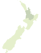

Scroll down to see a more detailed road map and below that a topographical map showing the location of Stony Stream. The road map has been supplied by openstreetmap and the topographical map of Stony Stream has been supplied by Land Information New Zealand (LINZ).

Yes you can use the top static map for you school/university project or personal website with a link back. Contact me for any commercial use.

Stony Stream Map New Zealand


New Zealand places in our database
[ A ] [ B ] [ C ] [ D ] [ E ] [ F ] [ G ] [ H ] [ I ] [ J ] [ K ] [ L ] [ M ] [ N ] [ O ] [ P ] [ Q ] [ R ] [ S ] [ T ] [ U ] [ V ] [ W ] [ X ] [ Y ] [ Z ]


Closest 20 Streams to Stony Stream

Kaituna Stream ( 2.27km )   Dam Stream ( 4.25km )   Siberia Stream ( 4.54km )   Boom Stream ( 4.8km )   Third Branch ( 4.83km )   Paritu Stream ( 4.89km )   Paton Stream ( 5.01km )   Tawatawa Stream ( 5.37km )   First Branch ( 5.44km )   Walker Stream ( 5.52km )   Chelmsford Stream ( 5.58km )   Brunton Stream ( 5.8km )   Waitaia Stream ( 6.07km )   Fourth Branch ( 6.12km )   Second Branch ( 6.31km )   Sisters Stream ( 6.68km )   Duck Creek ( 6.79km )   Kapakapa Stream ( 6.96km )   Ngarua Stream ( 6.97km )   Culpan Stream ( 7.1km )   Woody Stream ( 7.34km )   Stadia Stream ( 7.4km )   Coulter Stream ( 7.49km )   Takatakahia Stream ( 7.61km )   Hikuai River ( 7.7km )   Hikuai Stream ( 7.7km )   Scots Stream ( 7.95km )   Camp Stream ( 8.17km )   Totara Stream ( 8.2km )   Opango Stream ( 8.2km )   Wahitapu Stream ( 8.39km )   Parihaka Stream ( 8.39km )   Onukuhou Stream ( 8.4km )   Gumdigger Stream ( 8.41km )   Fifth Branch ( 8.52km )   No. 6 Stream ( 8.84km )   Larkin Stream ( 8.92km )   ?pango Stream ( 8.97km )   Opango Stream ( 8.97km )   Otuwheti Stream ( 9km )