Map showing location of Eucre Flat


LINZ description: Feature shown on: NZMS260 V22 Edition 1 1983
Latitude: -39.727639
Longitude: 176.916472
Northing: 5595132.5
Easting: 1935681.6
Land District: Hawke's Bay
Feat Type: Flat
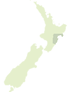

Scroll down to see a more detailed road map and below that a topographical map showing the location of Eucre Flat. The road map has been supplied by openstreetmap and the topographical map of Eucre Flat has been supplied by Land Information New Zealand (LINZ).

Yes you can use the top static map for you school/university project or personal website with a link back. Contact me for any commercial use.

Eucre Flat Map New Zealand


New Zealand places in our database
[ A ] [ B ] [ C ] [ D ] [ E ] [ F ] [ G ] [ H ] [ I ] [ J ] [ K ] [ L ] [ M ] [ N ] [ O ] [ P ] [ Q ] [ R ] [ S ] [ T ] [ U ] [ V ] [ W ] [ X ] [ Y ] [ Z ]


Closest 20 Flats to Eucre Flat

Eucre Flat ( 0km )   Te Paruparu Flats ( 12.75km )   Pigsty Flats ( 42.89km )   McIndoe Flat ( 51.78km )   Frying Pan Flat ( 51.85km )   Duff Flat ( 53.75km )   Taramea Flats ( 54.73km )   Takapau Plains ( 58.93km )   Kaweka Flats ( 67.08km )   First Flat ( 79km )   Second Flat ( 79.93km )   Third Flat ( 81.04km )   Fourth Flat ( 81.45km )   Taho Flats ( 116.82km )   Waione Flats ( 119.23km )   Makotuku Flat ( 129.57km )   Matengarau Flat ( 133.9km )   Taumapou Flat ( 135.92km )   Ohaerena Flat ( 138.71km )   Rangatipihi Flat ( 164.74km )   Otapora Flat ( 167.14km )   Tapuiwahine Flat ( 168.42km )   Mitre Flats ( 172.77km )   Donnelly Flat ( 179.41km )   Pig Flat ( 180.94km )   Totara Flats ( 186.62km )   Mamaku Plateau ( 208.08km )   Manukarere Flat ( 217.9km )   Te Kumi Flat ( 233.86km )   Hinau Flats ( 238.91km )   Rangitoto Flat ( 248.91km )   Holly Flat ( 251.78km )   Wharauroa Plateau ( 264.91km )   Taipouri Island ( 289.78km )   Hauraki Plains ( 294.62km )   Willow Flat ( 338.6km )   Franklin Flat ( 341.76km )   Surveyors Flat ( 344.16km )   Matai Flat ( 358.71km )   Ada Flat ( 363.35km )