Map showing location of Bouldery Stream


LINZ description: A tributary of the Spray River flowing north-westerly from The Pinnacles.
Latitude: -41.864105
Longitude: 173.418783
Northing: 5365227.1
Easting: 1634756.3
Land District: Marlborough
Feat Type: Stream
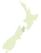

Scroll down to see a more detailed road map and below that a topographical map showing the location of Bouldery Stream. The road map has been supplied by openstreetmap and the topographical map of Bouldery Stream has been supplied by Land Information New Zealand (LINZ).

Yes you can use the top static map for you school/university project or personal website with a link back. Contact me for any commercial use.

Bouldery Stream Map New Zealand


New Zealand places in our database
[ A ] [ B ] [ C ] [ D ] [ E ] [ F ] [ G ] [ H ] [ I ] [ J ] [ K ] [ L ] [ M ] [ N ] [ O ] [ P ] [ Q ] [ R ] [ S ] [ T ] [ U ] [ V ] [ W ] [ X ] [ Y ] [ Z ]


Closest 20 Streams to Bouldery Stream

Bouldery Stream ( 0km )   Whare Stream ( 2.39km )   Spray River ( 2.71km )   Little Castle Stream ( 4.58km )   Glazebrook Stream ( 5.79km )   Manuka Stream ( 6km )   Wild Pup Stream ( 6.11km )   Stans Creek ( 6.59km )   Castle River ( 6.73km )   Enchanted Stream ( 7.5km )   Blue Mountain Stream ( 8.11km )   Tommy Stream ( 8.46km )   Burnt Country Creek ( 8.58km )   Noisy Stream ( 8.96km )   Pinnacle Stream ( 9.74km )   Shingley Stream ( 9.8km )   Lee Brook ( 10.02km )   Boundary Stream ( 10.15km )   Upcot Stream ( 10.84km )   Waterfall Stream ( 11.03km )   House Creek ( 11.46km )   Gosling Stream ( 11.7km )   Tame Stream ( 11.73km )   Ward Stream ( 11.78km )   Pass Brook ( 11.79km )   Cow Stream ( 12.76km )   Kellings Creek ( 12.87km )   Non Upton Brook ( 13km )   Te Arowhenua Creek ( 13.31km )   Grey River ( 13.49km )   Cannister Creek ( 13.51km )   Langridge Stream ( 13.67km )   Krushen Stream ( 13.83km )   Five Mile Stream ( 13.92km )   Winterton River ( 14.21km )   Stony Stream ( 14.35km )   Middlehurst Stream ( 14.69km )   Bill Massey Creek ( 14.82km )   Upton Brook ( 14.88km )   Cow Stream ( 15.08km )