Map showing location of Whakaari/White Island


LINZ description: Active marine volcano in the Bay of Plenty.
Latitude: -37.520974
Longitude: 177.183931
Northing: 5839100
Easting: 1969800
Land District: South Auckland
Feat Type: Island
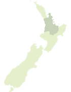

Scroll down to see a more detailed road map and below that a topographical map showing the location of Whakaari/White Island. The road map has been supplied by openstreetmap and the topographical map of Whakaari/White Island has been supplied by Land Information New Zealand (LINZ).

Yes you can use the top static map for you school/university project or personal website with a link back. Contact me for any commercial use.

Whakaari/White Island Map New Zealand


New Zealand places in our database
[ A ] [ B ] [ C ] [ D ] [ E ] [ F ] [ G ] [ H ] [ I ] [ J ] [ K ] [ L ] [ M ] [ N ] [ O ] [ P ] [ Q ] [ R ] [ S ] [ T ] [ U ] [ V ] [ W ] [ X ] [ Y ] [ Z ]


Closest 20 Islands to Whakaari/White Island

Club Rock ( 1.73km )   Moutohora Island ( 41.62km )   Motuhora ( 41.62km )   Moutoki Island ( 43.48km )   Rurima Island ( 44.05km )   Tokata Island ( 44.26km )   Motunui Island ( 50.62km )   Motukotare Island ( 50.84km )   Ohakana Island ( 52.53km )   Te Huka Island ( 53.02km )   Whangakopikopiko Island ( 53.28km )   Uretara Island ( 53.62km )   Motuotu Island ( 54.38km )   Hokianga Island ( 55.57km )   Motu Papaku Islands ( 56.27km )   Motu Papaka Islands ( 56.27km )   Motu Kaimeanui Island ( 56.58km )   Pataua Island ( 57.04km )   Patawa Island ( 57.04km )   Plate Island ( 57.2km )   Motunau (Plate Island) ( 57.2km )   Motuhaku Island (Schooner Rocks) ( 58.77km )   Motuputa Island ( 65.77km )   Motukahakaha Island ( 66.72km )   Motiti Island ( 67.22km )   Matarehua Island ( 67.6km )   Turitea Island ( 67.66km )   Motupatiki Island ( 67.68km )   Taumaihi Island ( 70.07km )   Otarawhata Island ( 70.49km )   Motuoneone Island ( 84.38km )   Tawakewake Island (The Queen) ( 85.31km )   Tokopapa Island ( 85.6km )   Mayor Island (Tuhua) ( 86.96km )   Motuotau Island ( 88.09km )   Pateko Island ( 88.58km )   Moturiki Island ( 88.88km )   Motumauri Island ( 91.05km )   Motuopuhi Island (Rat Island) ( 91.86km )   Motuopae Island (Peach Island) ( 92.51km )