Map showing location of Tunupō
LINZ description: Located at the northern end of Ngamoko Range in the Ruahine Range, at height 1568m. NZTopo50 BL36-Norsewood, GR 623 714.
Latitude: -39.966957
Longitude: 176.071545
Northing: 5571391.1
Easting: 1862334.7
Land District: Wellington
Feat Type: Hill
Latitude: -39.966957
Longitude: 176.071545
Northing: 5571391.1
Easting: 1862334.7
Land District: Wellington
Feat Type: Hill
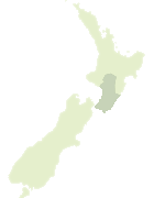
Scroll down to see a more detailed road map and below that a topographical map showing the location of Tunupō. The road map has been supplied by openstreetmap and the topographical map of Tunupō has been supplied by Land Information New Zealand (LINZ).
Yes you can use the top static map for you school/university project or personal website with a link back. Contact me for any commercial use.

[ A ] [ B ] [ C ] [ D ] [ E ] [ F ] [ G ] [ H ] [ I ] [ J ] [ K ] [ L ] [ M ] [ N ] [ O ] [ P ] [ Q ] [ R ] [ S ] [ T ] [ U ] [ V ] [ W ] [ X ] [ Y ] [ Z ]