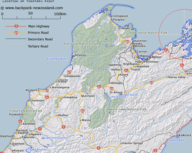
Map showing location of Tokatapu Point


LINZ description: Feature shown on: NZMS260 O26 P25 Pt P26 Edition 1 1980; NZTopo50-BP28 662674
Latitude: -40.942126
Longitude: 173.786093
Northing: 5467370
Easting: 1666169.7
Land District: Nelson
Feat Type: Point


Scroll down to see a more detailed road map and below that a topographical map showing the location of Tokatapu Point. The road map has been supplied by openstreetmap and the topographical map of Tokatapu Point has been supplied by Land Information New Zealand (LINZ).

Yes you can use the top static map for you school/university project or personal website with a link back. Contact me for any commercial use.
Tokatapu Point Map New Zealand


New Zealand places in our database
[ A ] [ B ] [ C ] [ D ] [ E ] [ F ] [ G ] [ H ] [ I ] [ J ] [ K ] [ L ] [ M ] [ N ] [ O ] [ P ] [ Q ] [ R ] [ S ] [ T ] [ U ] [ V ] [ W ] [ X ] [ Y ] [ Z ]


Closest 20 Points to Tokatapu Point

Sauvage Point ( 1.18km )   Two Island Point ( 2.15km )   Audibert Point ( 2.37km )   Reynaud Point ( 3.17km )   Okure Point ( 3.85km )   Okuri Point ( 3.85km )   Cross Point ( 4.06km )   Channel Point ( 4.58km )   Reef Point ( 4.73km )   Iron Pot Spur ( 5km )   Collinet Point ( 5.22km )   ?k?rewa Point ( 5.4km )   Fraser Head ( 5.47km )   Cove Point ( 5.47km )   Tobacco Point ( 5.57km )   Clayface Point ( 5.93km )   Te ?kau Point ( 6.54km )   Wharet?tara Point ( 7.66km )   Garne Point ( 8.03km )   Matatoko Point ( 8.43km )   Sheep Point ( 8.72km )   P?hakorea Point ( 9.06km )   Long Reef Point ( 9.09km )   Tunnel Point ( 9.4km )   Point George ( 9.9km )   Cape Zach ( 9.91km )   Reef Point ( 10.01km )   Camel Point ( 10.23km )   Whangapoto Point ( 10.33km )   Boulder Spit Point ( 10.43km )   Anchor Point ( 11.11km )   Fryingpan Point ( 11.37km )   Wiffen Point ( 11.51km )   Te P?keka Point ( 11.96km )   Ragged Point ( 12.22km )   Treble Tree Point (Otuhoto) ( 12.6km )   Rock Point ( 12.64km )   Te Ekeatekonganui (Reef Point) ( 12.67km )   Matakoi Point ( 12.72km )   Red Point ( 12.74km )