Map showing location of Tokangawhā / Split Apple Rock
LINZ description: A rock just off the coast of Towers Bay adjacent to Tokongawha Point, approximately 2 km north of Kaiteriteri. NZTopo50-BP25 017592.
Latitude: -41.018227
Longitude: 173.020283
Northing: 5459219.4
Easting: 1601705.4
Land District: Nelson
Feat Type: Rock
Latitude: -41.018227
Longitude: 173.020283
Northing: 5459219.4
Easting: 1601705.4
Land District: Nelson
Feat Type: Rock
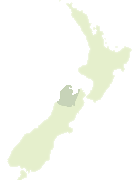
Scroll down to see a more detailed road map and below that a topographical map showing the location of Tokangawhā / Split Apple Rock. The road map has been supplied by openstreetmap and the topographical map of Tokangawhā / Split Apple Rock has been supplied by Land Information New Zealand (LINZ).
Yes you can use the top static map for you school/university project or personal website with a link back. Contact me for any commercial use.

[ A ] [ B ] [ C ] [ D ] [ E ] [ F ] [ G ] [ H ] [ I ] [ J ] [ K ] [ L ] [ M ] [ N ] [ O ] [ P ] [ Q ] [ R ] [ S ] [ T ] [ U ] [ V ] [ W ] [ X ] [ Y ] [ Z ]